Sunday, August 19, 2012

Bartram Trail- Nantahala Lake to Wine Spring Bald

 From the Nantahala Lake Trailhead (3013 feet), the Bartram Trail climbs steeply through lush forest before joining an old road, passing several meadows with abundant wildflowers, and finally intersecting the Appalachian Trail near Wine Spring Bald (5440 feet).  Solitude was again plentiful on the Bartram-- no other hikers were seen during my out-and-back hike.
After climbing over 2000 feet, I was rewarded with spectacular views of fog.
Rain predominated, but for one magical moment the sun crept out and clouds shifted to light up the flowers.


For directions and maps, go to the NC Bartram Trail Associations website.

Monday, August 6, 2012

Bartram Trail-- Buckeye Creek to "The Bus"

From Buckeye Creek trailhead out and back to "the Bus" turned out to be a nice relaxing dayhike.  It was perfect for a weekend when I was still sick and needing to take it easy.  The ~1200 foot climb was so gradual that I didn't even notice.  There were also rocky outcrops with views at the top, plenty of flowers along the way, and the soothing sound of springs and creeks at lower elevations near the trailhead.  Once again the Bartram Trail offered plenty of peace and quiet-- there were no other hikers seen the whole day.
Overcast sky's but the thunderstorms thankfully held off
Once again, my gaitors protected my legs from briers on the exposed, overgrown parts of the trail.

Made it to"The Bus"
This section of passed through several distinct forest communities, including the special Cedar Woodland plant community on Cedar Cliff, with Eastern Red Cedar and several rare and sensitive plants.  Botanical highlights included Carolina lilies, yellow fringed orchids, and large patches of fragrant mountain mint.  Rosepink (Sabatia sp.) were especially enchanting, and you can read out their cool ability to avoid self-fertilization here.
Rosepink with exposed, curly style

For more infomation and directions to the trailhead:
http://ncbartramtrail.org/section2/

Sunday, July 29, 2012

Thrilling botanical update: Pawpaw

After searching for several years, I finally found unripe pawpaw fruit in South Carolina.  Pawpaws were always one of my favorite fall delicacies when I lived near DC, but this is the first time I've found fruits here in the southeast.  These lovely little fruits were along the banks of the Chauga River at Chau Ram County Park, where I led a Trail Dames hike last weekend.  I can hardly wait to go back in a few weeks to find out when these delicious native fruits ripen. 
Unripe pawpaw fruits

Monday, July 23, 2012

Bartram Trail- Wallace Branch to Harrison Gap

My out-and-back section hike of the Bartram Trail between Wallace Branch and Harrison Gap was quite hot, since it was lower elevation and along sunnier slopes.  But the wildflowers were still spectacular enough to keep me happy, and the views of the early morning fog in the valley were lovely.
View from William's Pulpit.
North of William's Pulpit, the trail was peaceful and showed little signs of use.  Brush was overtaking the trail, so I wore my DIY gaiters to protect my legs.
Essential gear for this section: Excellent map + gaiters
I'd read that this section is more difficult (lots of P.U.D.'s) and that distances between water sources were great (both true), so I was glad to be doing this as a dayhike in this oppressive heat.  I went down the side trail at Locus Tree Gap #1 to check out the spring there, and it was still flowing a little, which was a good sign even though I didn't need any.

Once again the Bartram Trail lived up to its name, with abundant and diverse flowers.  I was really excited to find ripe mayapple fruits that hadn't already been eaten!  What a treat! 
Fringed orchid
Carolina lily
Mayapple fruit-- the pulp around the seeds is delicious!
For more information and directions for Section 4 of the Bartram Trail in NC click here.

Sunday, July 15, 2012

Bartram Trail- "The Bus" to Osage

The Bartram Trail in North Carolina between "The Bus" by Doubletop Fields and Osage Mountain Overlook is my new favorite trail section.  The high elevation and ridge with cool breezes provided an ideal summer escape.  I even felt cold enough (in JULY!) in the evening that I hiked wearing my poncho-- I kid you not.  Sheer rockfaces and mountain peaks provided spectacular views.  To top it off, there were abundant blueberries-- life just doesn't get any better!

Filling my belly with blueberries on top of Scaly Mountain
I parked at Osage Mountain Overlook, got shuttled to Jones Gap parking area, and started out northbound on the well-marked Bartram Trail in occasional rain.  After hiking north for 5.5 miles, "The Bus" (old rusted out schoolbus) provided an interesting turn-around point before heading back to Jones Gap, and then continuing on to Osage Overlook.
"The Bus" near Doubletop Fields
 On the way back, there was time to explore side trails, including the stunning Whiterock Mountain Summit (0.5 round trip).

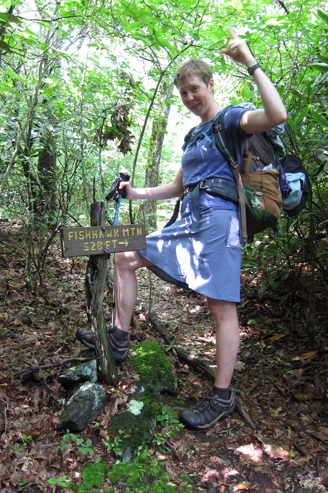
528 feet strait uphill


Most signs along the Bartram Trail gave distances to overlooks in miles (i.e. "0.3 miles").  The sign at the side trail to Fishhawk Mountain says "528 feet." I didn't realize they meant vertical feet, not horizontal, to the rocky outcrop summit (4748 ft) with no view.  Judging from moss in the trail, few others make the journey.  Though pretty much the entire section looked like it sees few visitors- I only saw two dayhikers, and one guy at the trailhead.

The steep technical footing, slippery terrain left me exhausted by the time I reached Tessentee Creek Camp.  I quickly fell asleep in my hammock to the rushing of the water.

Tessentee Creek and blooming rhododendrons
The next morning was only 4.4 miles to Osage Mtn. Overlook, but climbed over 1000 feet up and over Scaly Mountain (4804 feet).  I lingered along this stunningly beautiful section of trail, picking wild blueberries, checking out the plants, and soaking in the extensive views.
 Descending Scaly Mountain, small streams cascaded down the trail in some spots over exposed bedrock, creating deep water in some parts, and very slippery trail in others.  I splashed on through the water right down the middle of the trail to avoid trampling the banks, which would eventually widen the trail and kill sensitive plants. 

Puddle jumping along the trail.
For trail info:  http://www.trailquest.net/BRbartram.html

Sunday, July 8, 2012

Hemphill Bald Loop in the Smokies

My friend suggested the 13 mile Hemphill Bald loop in the Smoky Mountain National Park, and this turned out to be an incredibly fun trip.   A few days before our trip, a big storm hit the western part of the park and caused a lot of damage but I confirmed with the ranger station that this area didn't see any storm damage so we were lucky we didn't have to cancel.  The weekend turned out to be nice and cool up at 5,000 feet, and once again we got lots of solitude-- only two couples out dayhiking the first day, but no one else at camp or the second day.

After a slight detour for filling out a backcountry permit at Oconaluftee Visitor Center, we parked at Polls Gap, and started on the Hemphill Bald Trail.  Wildflowers were gorgeous along the ridge, especially the turk's cap lilies and rhododendrons.
Rhododendron tunnel on the Hemphill Bald Trail
Old fence built by the CCC
Fly poison
The trail near the bald was overgrown with dense, tall brush.  We changed into our long underwear to protect our legs from scratchy briers and itchy plants.
Guess who always packs long underwear even when the forecast is in the 90's?
Hemphill Bald is adjacent to a ranch.  We crossed over the fence, dodged cow patties, and took a rest on a big downed tree.
Backpacking is such hard work.
Campsite #41, which doesn't need a reservation, was large and near a stream lined with wildflowers and blooming rhododendrons.

The next day we passed by the Big Poplars.
Treehugger!
The last part was uphill on loose rocks, and this trail was more difficult because it has seen lots of damage from horses.

Overall, it was a great trip and we'll have to go back to the Smokies again soon!

Bartram Trail-- Osage to Rabun Bald

I've been using several tricks to keep me cooler and safer when hiking in the heat of the South.  I just got a new map of the Bartram Trail, so I couldn't bear to stay home despite the record 108 temperatures in town.  I decided to get to high elevation for an out-and-back dayhike from Osage Mountain Overlook parking area south along the Bartram Trail to Rabun Bald. 
The forecast for the nearest mountain town is 95.
I got a very early start in the cool of the morning.  The trail began in the dense shade of rhododendron thickets.
Add caption
Natural air conditioning was plentiful.  I took off my shirt, soaked it in the stream, then put it back on, and dunked my head too. 
The trail south of Osage Overlook had plenty of clear cold water despite the drought.
Staying hydrated requires that I make sure I eat well too.  Many years ago, I got heat exhaustion/ dehydration and ended up with an IV was because I wasn't eating enough salt, electrolytes, and real food.  Now I know that if my lips are chapped, if I have a headache, and if I get nauseous, that means I am dehydrated and need to drink and eat.  Fresh food, peanut butter, and salty snacks work best for me. 
Shrimp, corn, okra, and green bean salad.
I take care to avoid overexerting and getting overheated.  I keep my heat rate lower than I would under normal conditions by going more slowly and taking more frequent breaks.

Temperatures drop about 4-5 degrees for every 1000 feet of elevation gained, so I started high, and went up higher.
Summit of Rabun Bald (4696 feet), the second highest peak in Georgia.
For directions:
http://ncbartramtrail.org/section1/