Showing posts with label Benton Mackaye Trail. Show all posts

Sunday, July 15, 2018

Heart of Darkness on the BMT

Longing for open sky, the ridgewalking and balds shown on the topo map for this section of the Benton MacKaye Trail seemed tantalizing. When I found that the trailhead was less than 2 hours away, I decided to make sections 14-16 of the BMT along the TN/NC border my weekend backpacking trip without researching anything else.

Misty morning

The ridgewalking seemed to stretch for miles but there were only tiny glimpses of sky through the tunnel of green. The reality of southeastern forests is that the nature here envelops you. A jungle-like greenery seemed to reach out to fill the air. Thick spider webs adhered to sweaty skin as if stuck with superglue. Nature was constantly flying into my eyes (no-see-ums!), buzzing in my ears, and biting through my skin (ticks, sweatbees, mosquitos!). Even the air itself seemed thick to breathe, laden with humidity.

Wading through.

Along the ridge, beauty could be found not by looking out, but looking close at the tangle of life.
Rocks jutted up along the spine created ideal habitat for lichen and rockcap fern. Hill-topping butterflies danced along the ridge looking for mates.

Red-spotted purple (Limenitis arthemis) mimics the coloration of the poisonous pipevine swallowtail to avoid getting eaten.
Rock with lichen and mosses.
Tall bellflower

Little did I know that the BMT trail maintainers refer to this remote, jungle-like section as the “Heart of Darkness." Dedicated volunteers do regular brushing to open up the trail but the brambles grow back quickly each year. I hiked for miles through freshly brushed-out trail, thankful for their hard work.

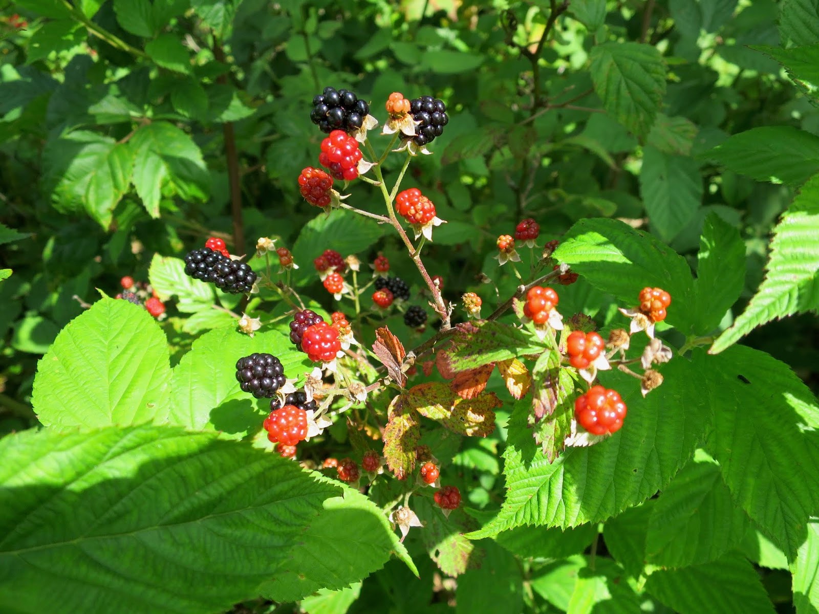
The culprit. Also, delicious.

But then I got to the end of the maintained section, where the brambles were thick and high. If only I'd checked the BMT website, I would have seen their warning. But alas, I didn't plan ahead.

How long do you hike through blackberries before you turn around? What if you are on an out-and-back? Knowing the further you go, that it only adds to the distance you will have on the way back.

Putting on my rainpants and diving into the neck-high mess.

I made it a mile. Had to because I was out of water in 90 degree heat and needed to get to the next spring. But after filling up at the spring, I cut my trip short and turned around. I'd had enough up-close nature.

Always a good night's rest and thankful for a bugnet.
Side trip from Sixmile Gap up to Waucheesi Mountain. Finally got a view, even though the communication tower and trash detracted from the ambiance.

Details

This out-and-back backpacking trip was along the Benton Mackaye Trail from TN Hwy 68 to near Round Top (and back). It included parts of Sections 14, 15, and 16. This section is lightly used and no other people were seen.

The Benton Mackaye Trail Association has a great website with all the resources, maps, and information you need. Check it before you go so you can avoid problems.

Wednesday, June 27, 2018

Big Frog on the BMT

A short overnight backpacking trip on the Benton Mackaye Trail Section 11 in Tennessee provided two favorite summertime treats: swimming holes and ripe berries. Perfect for the intense heat!

Section 11 of the BMT climbs gradually from a low point at the Ocoee River (1120 feet) up and over the summit of Big Frog Mountain (4224 feet), namesake mountain of the Big Frog Wilderness, and then down to Double Springs Gap at the Georgia/ Tennessee border.

Ocoee River
The start of the hike crossed over several dirt roads but then finally entered the wilderness. Following old logging roads made for easy hiking.

Former logging roads turning back to nature.
 Ripe red raspberries grew in thickets along the old roads. Sweet and juicy. The taste of summer.

All mine.
It felt great to enter into the wilderness area. The Big Frog Wilderness of Tennessee borders the Cohutta Wilderness of Georgia. Combined, they form the largest tract of Wilderness USFS land in the eastern US. This section only had "winter views" which meant that there were only partial views obscured by leaves. But at least I could imagine the vastness.

Once in the wilderness, the BMT follows the West Fork of Rough Creek, one of the prettiest places I've been to in the southeast. Hemlock and great rhododendron in full bloom line the banks of this sweet bubbling stream.

Massive pink blossoms filling the air.
Plunging into a bubbling creek on a hot summer day might just be one of the greatest pleasures in life. I splashed around for what seemed like hours, with butterflies and jewelwings dancing around my head. A lazy lunch on mossy rocks while soaking my feet, until my feet turned to prunes. Even though I've had some pretty epic swims in the last few years, this one stands out for the lovely wildflowers, insects, and jacuzzi-like water, and because it was so intensely hot out.

Definitely one of the best swims EVER!
Azures all around.

Long tunnels of mountain laurel
Even though there were only obscured views through the trees, the ridgewalking went on for miles. And there was a wonderful sense of being up high.

 Big Frog Mountain (4,224 feet elevation) is named by the Cherokee for the spring frog, which emerges early in the season. I didn’t get to see any frogs, but salamanders were out roaming before the storm.

A woodland salamander prowling around
Other wildlife was abundant. I startled two black bears who ran off.
This timber rattlesnake stayed put on the trail. So I was the one who went the long way around.
On the approach up Big Frog Mountain
Once I got to the top, I continued south down over the crest. A steep mile or so that descended a bit over a thousand feet. The turn around point of my trip was Double Springs Gap, which indeed has two springs, one on either side of the Tennessee Divide. One side goes out the Conasauga River to the Tensaw River to the Gulf of Mexico at Mobile Bay. The other spring flows to the Ocoee River and eventually to the Mississippi. After cooling off at both springs, I turned around and climbed back up Big Frog, and descended more gradually going northbound.

Evening.
Storms came rolling through in the evening, but not before I had set up for the night. I'd forgotten just how much I love the sound of rain on my tarp. The skies cleared the next morning for the quick hike back to the river.

A sub-24 hour trip, but it was good to get out!

Red-spotted purple butterflies are a great example of a Batesian mimic. They show similar coloration to the unpalatable pipevine swallowtail, so predators are fooled into not eating them even though they are palatable.

More information 

I did this as an out and back from Thunder Rock Campground, which has good parking for BMT hikers.

Here is the trail guide from the BMT association

A Quick and Dirty Guide to the BMT

Wednesday, June 20, 2018

A sort-of quiet trip on the BMT

A weekend backpacking trip on the Benton Mackaye Trail sections 1 and 2 in Georgia.

Following the white-dimonds

I was looking for some peace and quiet after a busy week and the BMT is usually good for solitude. After hiking the Approach Trail last weekend, a visit to Springer Mountain from the other direction seemed appealing. Access to the trailhead at Little Skeenah Creek via GA 60 is easy, maximizing hiking time.

Marker on section 1 of the BMT, located just after the first split with the Appalachian Trail.

I’ve previously hiked these sections of the BMT during winter but it felt like a completely different experience in the heat of summer.

Bright green tunnel.

Fortunately, there are plenty of streams, springs, and even a river on this section for cooling off.

The Toccoa River Bridge is the longest Swinging Bridge east of the Mississippi at 270 feet.
Great rhododendron (Rhododendron maximum) was still blooming along the river.

A downside of summer is that the no-see-ums were out in force. Constantly buzzing, make kamikaze trips into my eyeballs, and produce itchy welts. Oh what fun. 

Female ebony jewelwing were plentiful as well.
Ticks marched up my legs and I picked them off one by one, rippping off their heads with my fingernails. Because I'm only a friend of nature sometimes.

Long Creek Falls near Three Forks is where the BMT joins the AT.

The one mile section of the BMT that shares tread with the AT south of the falls felt like a superhighway. There was even a family with a parade of children pushing a stroller up the trail that made me smile because I like seeing kids outside. Quite a contrast to the quiet of the BMT.

Wide tread where the AT and BMT join.

The view from Owen's Overlook, just a few hundred feet off the BMT, provided more expansive views than Springer Mountain.

I choose a campsite near an open field that I hoped would provide clear views of the evening sky. The openness was a relief from the long green tunnel of the BMT. I haven't gotten used to the closed-in feeling of eastern forests after being out west these past few years.

So-called Bald.

Perhaps if I’d read the trail notes, the low-flying helicopters that flew directly over me as I hung in my hammock at the edge of “The Bald” wouldn’t have been so terrifying. Apparently the clearing is used by the US Army Rangers for training. But at least they only flew over a few times. Making this a quiet trip over-all, with a few notable exceptions.

More information

I did this hike as an out-and-back starting at GA 60 and hiking south on the BMT to Three Forks where I did a loop with the AT/BMT to Springer Mountain, and retraced my steps back to GA60.

The Benton Mackaye Trail Association's website has trail information and good trail notes.

A Quick and Dirty Guide to the BMT

Tuesday, September 10, 2013

On the JMT... of Tennessee

I couldn't help boasting about this trip, "This weekend, I'm backpacking the JMT… of Tennessee!"
The John Muir National Recreation Trail goes 20 miles along the Hiawassee River gorge in eastern Tennessee.  John Muir traveled this route on his long walk from Kentucky to the Gulf of Mexico, and Muir's description  (see here- read under Sept 19) of the incredible river still aptly describes the wonder of this river today.  
Water levels were low enough to exposed the unique jagged rock formations of the Hiawassee River.
My friend Salt and I began at the western end at Childers Creek trailhead, and we highly recommend the scenic first 3 miles to Big Bend.  It's well maintained and follows the northern bank of the Hiawassee River below towering bluffs.  The Benton Mackaye Trail Section 13 is concurrent with this part of the JMT.  
Fascinating geology and diverse plant community including pawpaws, one of my favorites.
Past Big Bend Parking Area, Hiawassee River Road is popular with fishermen, and there are frequent parking areas and boat launches with trashcans, picnic tables, and bathrooms.  The area (especially the nearby Ocoee River) is also a mecca for whitewater rafting and kayaking, and we wondered a few times why were hiking rather than staying cool in the water like the fishermen and boaters.
Joe pye weed along the Hiawassee River.
Lunch at one of the many picnic areas along Hiawassee River Road.
From Big Bend to Towee Creek, the trail left the river and ascended a very short distance up the hillside.  We stayed within sight of the road so it was pretty much like walking along road, only rougher and more difficult.  I'm not sure point of this but it did take us to an overlook along some rock formations.

The 2008 reroute between Towee Creek and Wildcat Creek led further away from the river and up over a tall bluff.  We followed beautiful Towee Creek before switchbacking up to the spine of the ridge.  It was a hot humid climb and we were dripping in sweat.  Afterwards we joked that we'd bagged a 14er.  Such bad-ass JMT hikers!  Of course it was only a 14-hundered footer, but whatever...
It was hard going.  Gnats were especially vicious and kept flying into nose, eyes, and ears. 
Our original plan had been to camp at Coker Creek, but the heat and mugginess had sapped so much energy that we decided not to go any further.  Hammocks were hung above a bluff over Wildcat Creek.  We had dinner under a rocky overhang, and soaked tired feet in the river while swatting (unsuccessfully) at the blood-thirsty no-see-ums.

In the morning, we decided to follow the old route of the JMT/BMT on the return trip to the car.  The section was much more used and still marked with signs and blazes all the way to the suspension bridge over the Hiwassee River and the Apalachian Power House.
Walking along the old route (rather than the reroute) provided lovely views of the river.  There were fishermen out all along this peaceful stretch of water.
The old trail markers showed where the old route used to veer off the road into dense forest along the riverbanks.  We followed the blazes through really overgrown trail and eventually got tired of fighting the thick brush.  We suspect other hikers also must walk the road which was much more pleasant.  Though I wonder how many people hike this stretch- we certainly didn't see any other backpackers, just one dayhiker, and lots of fishermen.
Overgrown section.
Just before we got back to the trailhead, as I was strolling along looking up at the pawpaw, Salt shouted something from behind me.
Looking up at the tons of pawpaws all along the trail.
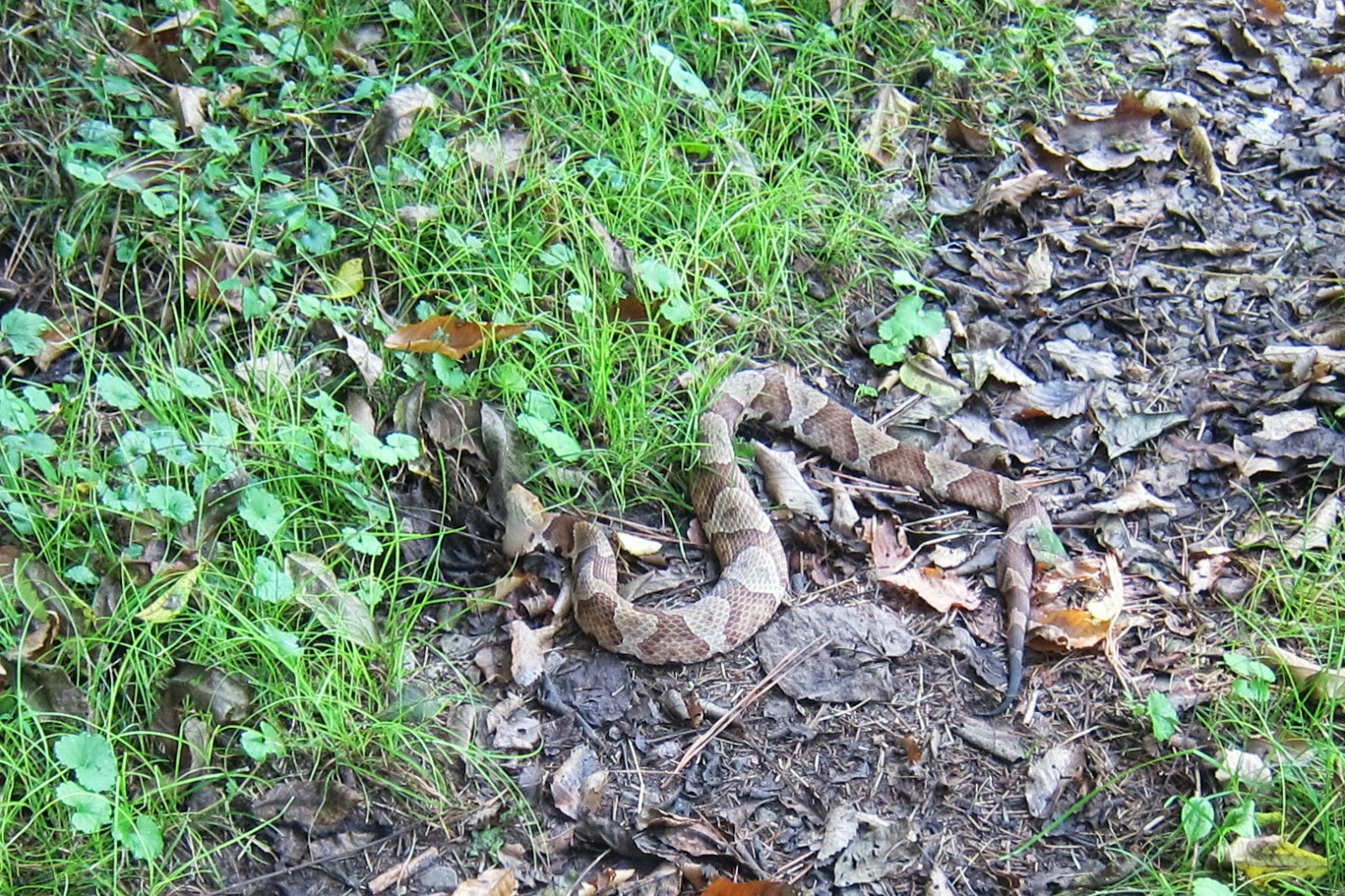
I walked a few steps further before turning around.  She exclaimed that I'd stepped on a snake!   Sure enough there was a copperhead in the path looking very angry. 
Anyway, she saw the snake move when I stepped on it, but it didn't bother me, not even a nibble.  And he looked to be still very alive.  Ironically, she'd just been talking about seeing a snake and how snakes are reported to be common along this section of trail.  I've since read that copperhead bites are really rare, that they only inject venom half the time anyway, and thought it's painful, hardly ever deadly.  Not that I'd ever step on one on purpose, but it's another thing that I'm not gonna fear.

Overall, the first few miles of the JMT from Childers Creek were exceptionally pretty and I think they'd make a fantastic day hike, especially in fall or winter when the weather wouldn't be so brutally hot.  It was great to be on the trail with my friend Salt and on the way home we scouted out the next trailhead for the BMT so I'll look forward to returning to this area for more adventures.

Information and trip planning notes
(note: information on the John Muir National Recreation Trail was really disappointing and lacking so I've included an annotated description of resources.)

Sherpa Guides has some regional information here.

The BMT Trail Guide for Tennesse showed the old and new reroute, which was helpful.  However, it wasn't as detailed about the confusing road crossings.

The Trails Illustrated map #781 Tellico and Ocoee Rivers is easier to read than the trail guide, and shows road access.  However, it didn't show the old BMT route, even though both new and old routes are still signed and blazed.  Potentially very confusing.

This Backpacker Magazine article on the JMT at least had directions to the trailheads and for the shuttle.  However, it doesn't describe the reroute even though it was published in 2010, and the description made us wonder if the author had actually hiked the trail.

Unfortunately, the BMTA trail descriptions that had been so helpful for sections 1-11 are not available for this section, but a map is available for free download.

Monday, March 11, 2013

Snow Storm Adventures Part 2

***It took me a while to post this, even though it happened in early February...***

After the unexpected snow storm on a the first Saturday in February (read about the Snow Storm Adventure Part 1 here), my car was stuck in the mountains for a few days while the snow melted and I took the bus around town.  But the adventure continued on Wednesday, when my awesome friend JJ volunteered for a car recovery mission.  She was so generous and drove me all the way up to pick up my car at Watson Gap.  I'm not sure how she knew this would be an "adventure" but she didn't seem as surprised as I was to find this:
My tire was dead flat.
JJ pointed out the big cut in the sidewall where my tire had been slashed.  I couldn't believe it!  Nothing like that had every happened to me.  Sheesh-  I'm a nice person. 

While I was changing the tire, a couple stopped to talk to us.  They were out picking up their car from a trailhead two miles further down the road, which had been left there since Sunday too.  They'd tried to pick it up Monday, but there was too much snow.  His window had gotten smashed and a few minor things had been stolen.   They figured it was probably the same guys that got my car and theirs.  It didn't seem particularly malicious-- and knowing it happened to them too made it feel less personal-- if it had been I'd have had 4 slashed tires, but it would still cost me both in money to fix it and time.  Plus, the psychological costs.

****
(Note that the next part was written a month later...)
In the past few weeks since it happened, having my tire slashed did had me reexamining my trailhead practices and attitudes.  It was tough questioning my sense of safety in the place I feel most comfortable-- the outdoors.

I already take many of the recommended measure to prevent trailhead problems.  For example, I call ranger districts and read online to find safer trailheads to leave my car.  One suggestion I haven't done yet- getting a beeter truck- is very tempting and all my friends suggest this to me.  But since this has only happened once in the four years I've been leaving it at trailheads practically every weekend, I'm reluctant to spend the money to buy another vehicle when my car is already paid off, and I cringe at the thought of paying any more at the pump for driving a gas-guzzler.
50 MPG = Why I'm reluctant to get another vehicle
But what about car a makeover so my car will blend in better in rural Georgia?  Perhaps some new tires, a camo paint job, or a few bumper stickers could make my fit in better at trailheads?  (Any other suggestions, y'all?)

Even though I understand that it's totally ridiculous endevoir because my car will always be a honda civic hybrid no matter how much I dress it up in rural camouflage.  Sort of like me attempting to fit in in the South-- rather hopeless, but it's fun to joke about.
Studying up and researching local culture.
This whole experience-- from getting stuck in the mountains in the snow to getting my tire slashed-- it all had the potential to take away my sense of freedom and safety.  But remarkably, that hasn't happened.  At least not much.  Instead, I have gained a profound appreciation for the kindness of strangers, and especially for the kindness of my friends that have given me so much support.  The biggest lesson has been that when the unexpected happens, I know I can still maintain an unwaveringly positive outlook, and I can count on my dear friends to be there for me.  Each time something goes wrong on the trail or I have to face something that scares me, it strengthens me.  Thick skin, scars, calluses, these take a while to build up, but make you tough.

Sunday, February 3, 2013

Snow Storm Adventures Part 1

Like any true adventure, I learned more and ended up having way more fun on this trip than a typical trip where things go according to plan.

After setting up the shuttle, the trip began at Bushy Head Gap on the Benton MacKaye Trail.  The plan was for an overnight backpack on Sections 8 and 9 with a guy I met on the Hammock Forum hang.  Rain was forecast in the evening, but the morning started off cool but dry.
By mid-morning the first snowflakes began to fall.  "Surely the snow won't stick!"   The forecast didn't say anything about accumulations...
Gorgeous snow quickly transformed the forest.
Nevertheless, several inches cloaked the forest by lunchtime, and the large puffy flakes showed no sign of letting up.  I was prepared for cold temperatures and rain, but this?  Continuting on meant higher elevations, more remote terrain, and potentially dangerous weather.  We decided to hike back out to Bushy Head Gap.  It turned out to be a good call- I would later find out that my car (parked at Watson Gap) would not have made it down that steep mountain road with all that snow for a few days.

The road was so slick and steep that we didn't make it even a mile before my friend's truck got stuck in the road.  Local guys, driving around in their trucks around seemingly for fun, offered to help move the truck.
A rope tied around a tree prevented the truck from sliding down the cliff...
...though unfortunately it still ended up stuck in the ditch on the other side of the road.
 I was quite impressed how everyone was so willing to help out.  (Though granted their path was blocked...)  Some of these guys willingly put selves on the downslope side of a truck on such slippery footing -- for complete strangers-- this was dangerous stuff.  It was something else!

And the kindness didn't stop there!  A couple who had stopped to help also offered a ride into town in their jeep.   We lucked out because they knew where to drop us off too--  the Waffle King, the local hangout and place to be in Blue Ridge (waffles AND beer!) where there were more offers of help along with the endless refills of hot coffee.  Seeing our backpackspacks and overhearing our story, strangers (whose nephew had hiked the AT) offer to buy us a hotel room.  More sweet folks at Waffle King offered advice and wrecker service recommendations, then finally offered us a ride to cars- offers that we didn't accept but for which I am grateful.

As evening approached, I informed my super-awesome friend Kellye and also my wonderful roommate Karen of my situation.  Let me tell you-- there is nothing in the world like getting a message saying "Do I need to come get you?" on a snowy day when you are a hundred miles away.  Due to the hazardous road conditions, we ended up staying the night at a hotel.  But the next day, my friends totally came through for me- both ended up driving me parts of the long, long way home.  Now that's real friendship! 

But the adventure wasn't over yet....  Stay tuned for Part 2...