Showing posts with label Foothills Trail. Show all posts

Friday, November 14, 2014

Foothills Trail Thru Hike

While I’ve section hiked the Foothills Trail repeatedly, this was the first time I’ve completed the entire trail in one continuous trip.  I was thrilled to do this hike with my friend Susan (“Rewind”) who you might remember I started the PCT with (check out her blog here).  The really great thing about hiking with Susan is that she shares a fondness for the natural world and for plants in particular.  Perfect hiking partner for this trail with all the fall color!  We spent time examining colorful fall leaves, pulling apart seeds and fruits to figure out what they were, and lifting up rocks to look for salamanders.  This was quite a different mindset that I used to have on previous trips on the Foothills when I’d do over 25 mile days, back when I had something to prove.  But it was a fabulous way to enjoy this exceptionally beautiful trail.
Susan on the Foothills Trail.
Overview of the Foothills Trail
The Foothills National Recreation Trail extends 77 miles from Oconee State Park to Table Rock State Park along the South Carolina/ North Carolina border.  Highlights include the Chattooga Wild and Scenic River in the Ellicott Rock Wilderness, Gorges State Park, Lake Jocassee, Sassafras Mountain (the highest point in South Carolina at 3554 feet), and Whitewater Falls (second highest falls in the east). 
Whitewater Falls.  Photo by Susan.
Time of year
Our trip took place in mid-November, and we caught the BEST EVER fall leaf color.  I’ve section hiked the Foothills Trail pretty much all months of the year and do tend to like the spring flowers, but the leaf color made November a close contender for best time to hike.  The Foothills Trail stays at a lower in elevation than the Appalachian Trail in Georgia and North Carolina, so the weather remains relatively moderate during winter.  We had a few days warm enough to go swimming, but by the end of the trip a front came through that brought rain and then freezing temps.
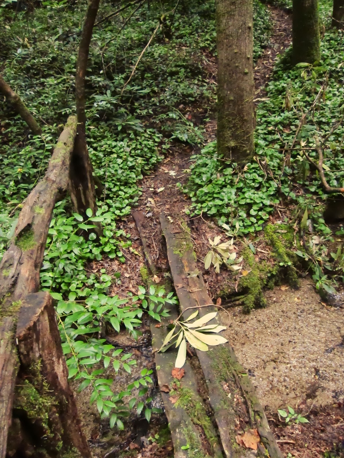
Horsepasture River.
Trip duration and direction
I highly recommend allowing extra time to hike this trail.  We spent 5 nights which allowed for a very relaxed trip.  Sure we could have finished quicker (being the badass PCT hikers that we are- haha), but neither of were eager to get back to town.  So we dragged out our trip, exploring side trails that took us to additional waterfalls.  Because the days are short this time of year and evenings got cold, we also ended up going to bed quite early.  Like around 6 PM.  So even though we’d get hiking before the sunrise, we were glad to have planned extra days to account for these shorter days.  

We choose to start at Oconee State Park so that we could do the part of the trail with the least amount of elevation change at the beginning of our trip when our packs were heaviest with food.  It also allowed us to save the dramatic views at Sassafras and Table Rock for the end.
Susan and I at the Oconee State Park Trailhead.
Wonderful waterfalls
What makes the Foothills Trail really stand out are the waterfalls- more waterfalls than I’ve ever seen anywhere else.  This is because the trail goes along the Blue Ridge Escarpment, which is the 2,000 foot drop-off between the higher Carolina Mountains and the lower Piedmont.  This is an area that gets more rainfall than most other places east of the Mississippi, and all that water flows down a series of gorges.
Virginia Hawkins Falls.
One of the distinguishing features of this trail are all the steps and bridges.  Big iron bridges, and wooden bridges of all shapes and sizes.
Over the Laurel Fork.
 Parts of the trail are along the fall-line, and steps lead steeply up and down, providing quite a stairmaster workout.  Footing is often technical, the trail being rocky and rooty, and we had to adjust our pace and ended up going slower than we would on the PCT.
Endless stairs.
Water is plentiful along the route.  The longest water carry is over Sassafras Mountain, which is also a steep section so watch out that you don’t get complacent expecting water every few miles and run out here.   Also while it may be tempting to camp along the gorgeous streams and rivers, in winter these areas turn especially cold and damp at night, and we stayed much warmer by camping up on the ridges where the views of the sunrises and sunsets were better anyway.

Flora and fauna
The Foothills Trail passes through many botanically rich areas and the wildflowers in April and May are exceptional.  One of the most exciting botanical highlights of the Foothills Trail are the endangered (but locally abundant) Oconee Bells, which are endemic to the Southern Blue Ridge Mountains.  They grow along streams, are related to the more common galax, and bloom in March and April (see my photos of them here).  The famous French botanist Andre Michaux collected the Oconee Bell in 1787 and the famous American botanist, Asa Gray, found Michaux’s record of the plant years later, and kicked off a several-decade long hunt for the plant which wasn’t rediscovered until 1877 (read the full story here).
Witchhazel blooms in November.
The Foothills Trail also has a fair amount of wildlife.  One evening, we got to see a small black bear scamper up the far hillside one after we’d set up camp.  Fortunately, it didn’t seem to be interested in us and didn’t return to our camp.
Susan hangs her bear bag.
Overall, this is a gem of a trail and fall is a great time to visit.
Toad.
More information and Maps

Foothills Trail Conference- information and maps/ guidebooks.

Allen Easler- overview and more information on the waterfalls

The Foothills Trail Map (by the Foothills Trail Conference)
(Edit: the new 2014 map from the Foothills Trail Conference is suppose to be a big improvement- see comments section below)
Unfortunately, this is a very difficult map to read and use.  All the information you need is here, but it is not organized in a way that makes sense or that is standard for other long trails.  The use of a numbering system instead of place names is particularly confusing.  Distances between these numbered waypoints is given in a chart, but then you have to reference another chart explaining what the numbers mean.  The elevation profile doesn’t show mileages on the x-axis either.  I solved these problem by taking a perminant marker and writing mileages directly on the map and replacing the numbering systems with actual names of waypoints and trail junctions to make a functional map.  On the upside, sales of this map benefit the FTC and go towards trail maintenance and construction.  Some people like the FTC Guidebook, which has more detailed descriptions, but I’ve hiked the trail before so I didn’t find that information necessary.  The trail is very well signed, blazed, and generally easy to follow.

National Geographic Trail Illustrated Map #785 of the Nantahala and Cullasaja Gorges
If you are section hiking the Foothills Trail, the NatGeo map shows roads and is helpful for getting to the trailsheads.

Monday, November 11, 2013

Foothills Trail: Around Whitewater Falls

My friend Still Waters joined me for a few hours at the start of my weekend backpacking trip.  From the Bad Creek Parking area for the Foothills Trail in South Carolina, we rambled along side trails to the big trees at Coons Branch Natural Area, and then out to Upper as well as Lower Whitewater Falls.
Tree hugger at the pocket of virgin forest at Coons Branch Natural Area.
I was bubbling with excitement about my plan for the PCT.   I’ve been working on my gear list, sewing some new gear, increasing the intensity of my workouts, and was full of ideas.  I talked poor Still Water’s ear off, but she said she was glad to see me out of my rut and back to my usual joyful self again.  
Look at the awesome new convertible mittens/ gloves that I constructed (0.5 oz less than the old gloves plus they cover my wrists and have two layers of fleece!!!!).
... and here are my new tarp skins made out of an old pair of tights!

Still Waters.
After Still Waters headed back home, I set out on the Foothills Trail towards the Thompson River and Hilliard Falls, which were both running really low. What a contrast to when I’d seen them flowing strong back in January!   

Leaves were at least a foot deep in spots, and I laughed to myself about "postholing" through the leaves. 

In fading light (hello daylight savings time), I scampered up a hillside to find a stealth campsite.   Setting up my tarp (and especially taking it down) was much faster with the new tarp skins.  I'll likely make another set with a lighter-weight material, though I rather like how the orange and black striped fabric contrasts with the real-tree camo print of the tarp. 
Packing the tarp into the new skins.
The next morning, I backtracked to Upper Whitewater Falls (even though I did the whitewater corridor the previous day, it’s worth repeating that section), and then continued on to SC 281, before turning around and heading back to my car at Bad Creek. 
Gorgeous fall foliage at Upper Whitewater Falls.
It’s strange to think about doing a continuous hike, rather than my usual out and backs (this trip involving out and back and out and backs too- another favorite!).  I always marvel at how much more I notice going the opposite direction, how different the trail looks in different light, how much easier the trail is going uphill rather than downhill (especially in thick wet leaves). What is it going to be like seeing new terrain every single day!?!?  Guess I'll find out...

Sunday, September 15, 2013

Overnight Loop on the Foothills, Winding Stair, and Big Bend Trails

Wanting to explore two trails that link to the Foothills Trail in South Carolina, I devised a 16.4 mile loop for a solo overnight on the Foothills Trail, Winding Stair Trail, and Big Bend Trails.  After section hiking the 77-mile Foothills Trail, I've been hiking all the spurs and side trails that connect to the Foothills because I love the area so much.  This loop turned out to be a very scenic, easy route with four impressive waterfalls and several unnamed smaller falls.  Even the roadwalk had a small waterfall!
Unnamed cascades along the Winding Stair Trail.
I parked at the Foothills Trail access at Cheohee Road (FS 710) right off SC 107.  If I were to do it again, parking at Nicholson Ford would have been safer, but this gave me a shorter drive.  The loop began with a 2.5 mile roadwalk down FS 710.  It was pleasant walking with views through the trees and diverse fall flowers. 

Winding Stair Trail (3.5 miles) headed up into the forest on the left after crossing Crane Creek over a bridge.  The parking area was unmarked but the trail itself was signed and adequately blazed.  This hidden gem is mostly used by dayhikers (i.e. no campsites evident).  Broad switchbacks wound gently up the hillside so the 1000 foot elevation gain was effortless.   Paths to two waterfalls required steep scrambles down rhododendron thickets, with much ducking required for tall people.  Miuka Falls was an impressive 70-foot cascade and Secret Falls was smaller but picturesque.  

After crossing SC 107, Big Bend Trail led 2.7 miles to the Chattooga River Trail/Foothills Trail.  It passed through really pretty forest, typical for the Chattooga River area, with large trees, doghobble lined streams, and mountain laurel.  Pine-needle cushioned trail made for easy walking. 
Pinesap lacks chlorophyll and gets its carbon by parasitizing fungi associated with pine trees.
Giant pines on the Big Bend Trail
Off the Foothills Trail, steep social trails through rhododendron tangles crisscrossed the riverbank overlooking Big Bend Falls.  You could feel the ground rumbling as the powerful Chattooga River thundered through narrow canyon.  I never did get a good photo, but believe me it's worth seeing (and hearing!).
Camping along the Chattooga River.
I set up camp on a sandy beach north of Rock Gorge along the Chattooga River.  After being focused on hiking and the trail, I finally had some time to think.  It was a tough week at work- I received the unexpected news that the funding for my job is ending sooner than I'd been previously told, and I'd been feeling very unsettled the past few days.  Thankfully, watching the sun set and the moon rise above the hills over the river was quite restorative.

The Chattooga River is one of those really special places for me.  I feel so at home in the forests through which it flows.  Its large evergreen trees, rhododendrons and ferns remind me of the forest of my childhood in Oregon.  I have made so many memories of trips on the trails that intersect the Chattooga- the Foothills, Bartram, and Chattooga River Trail.  It's tough thinking about leaving this place and all the friends I've made here, but it's also exciting to dream about what I'll do next. 

I woke early to hike the few miles to my car on the Foothills Trail, passing yet another falls.  It was a short trip, but exactly what I needed.
Lick Log Falls on the Foothills Trail.
For more information:

Tim Homan's Hiking Trial of the Southern Nantahala Wilderness and Chattooga River.

Trails Illustrated #778 Brasstown Bald and Chattooga River

Friday, September 6, 2013

Side Trails off the Foothils Trail, Part 2

Labor Day weekend on the Foothills side trails continues... (see here for Part 1)

After a restful night on Sassafras Mountain (highest point in South Carolina), my friend Still Waters and I drove over to the  Frozen Creek Access Area to begin the second part of the trip- an 18 mile loop through Gorges State Park in North Carolina on the Auger Hole, Foothills, and Canebreak Trails. 

I was both suspicious and thrilled that the trailhead was deserted when we arrived.  There had to be a good reason for that on a holiday weekend and I figured we'd soon find out.
Auger Hole Trail.
The 7.3 mile Auger Hole Trail wasn't the prettiest trail.  Wide doubletrack, thick spiderwebs, biting gnats.  It took effort to find beauty.  Brilliant green tiger beetles scampered up the trail.  Sometimes, you just have to settle for the little things.
Brief break from the heat at the crossing of the Toxaway River on the Auger Hole Trail.
When the trail opened up into a hot powerline cut, there was especially slippery loose gravel and rock.  Ugh.
I'm usually sure-footed, but I fell going down this steep part.
I was overjoyed to finally reach the soft surface of the Foothils Trail and step back into verdant forest.  While the Oconee Bells weren't blooming like when I'd backpacked this section last March, their lush evergreen leaves glistened along the banks of small babbling streams.  At first glance, they might look like galax, but you can tell they are actually the rare Oconee Bells by the leaf venation patterns. All thoughts of the previous section of tough trail were overshadowed by the botanical splendor.  A selective memory does wonders for ones general happiness.
Bridge over small stream on the Foothills Trail.
After 13 miles of solitude, I was pissed off when I heard motorboats and loud voices as I descended to the banks of Lake Jocassee.  I lightened up a bit when I saw kids frolicking in the shoals where the Toxaway River empties into the lake.  I was even more pleased when they all took off in their boats in the evening as the thunderstorms rolled through, leaving us in peace.
Morning light at the Toxaway River flowing into Lake Jocassee.
Next morning, it was five miles up the Canebreak Trail.  I honestly can't think of an uglier trail.  
The initial steep ascent up the Canebreak Trail, which follows more old roads.
Loose gravel make for tough walking on tired feet.
In an ideal world, there'd be more places that offered both solitude and scenic splendor.  But as it is, there is a tradeoff- in this case (ugly) trails provided solitude.  We encountered no other backpackers all weekend, though there were a few folks out for the day within a mile of the trailheads.  For a holiday weekend, it was worthwhile to put up with the trails over old roads to have some quiet and stay off the beaten track.  Plus, these trails led to places that were spectacular, despite being crowded with daytrippers that accessed them with their cars (on Sassafras Mtn) and motorboats (at Lake Jocassee).  It worked out well to have some of the best of both worlds.
The only other footprints on these trails were made my turkeys.
For more information on this loop:

Backpacker Magazine article.

Meanderthals Trip Report here.

Tuesday, September 3, 2013

Side Trails off the Foothills Trail, Part 1

Ever since I finished my hike of the Foothills Trail last year, I've been wanting to do the Foothills Spur as well as two side trails that form a loop with the Foothill Trail through Gorges State Park.  So I did a rather unusual configuration this Labor Day weekend to backpack all these trails.  My friend Still Waters give me a shuttle the first day, and then we drove to a different trailhead for the second night.  The extra driving was worthwhile because these side trails provided opportunities for exploring and adventure, and also had exceptional solitude.

Foothills Spur: Caesars Head to Sassafras Mountain (14.2 miles)

The first day my friend Still Waters drove me to Caesars Head State Park.  The Foothills Spur shares tread here with the Raven Cliff Falls Trail and the Gum Gap Trail, which had been closed when we'd visited the park a few weeks ago.
Starting out in fog on gentle trail.
After the first few miles, the Foothills spur follows a series of old roads, some of which I was delighted to learn were built in the 1930's by the CCC.  Often rocky, these roads made for difficult hiking and much time was spent looking around for rather sparse or worn blazes and consulting the map.
Warning sign say to stay on blazed trails to avoid getting lost.
The trail passes through the Watson-Cooper Heritage Preserve, which has the only montane bog in South Carolina, and harbors several rare plants.  An old book gave rough directions to the bog which involved unmarked/ unmaintained trails that I wanted to check out so I can go back next spring when the swamp pink are in bloom. I got totally wet and covered in mud from stooping under rhododendron thickets and tromping around in the bushes.  What fun, though I wished I'd only been carrying a daypack instead of my backpacking pack.  I was also really happy too not to get lost after passing those warning signs.  
Not very rare, but still pretty yellow fringed orchid at Watson-Cooper Heritage Preserve
Venturing down an unmarked side trail provided the most spectacular view of the day.  From the summit of Bursted Rock Mountain (3219 feet), an expansive rocky outcrop opened up to the south for a view of what I think must be Table Rock.  I stumbled upon this by veering south off the Foothills Spur (less than a mile east of Dolves Mountain) and following the orange blazes marking the NC/SC border for about a quart of a mile strait up the mountain.  Not sure how many people know about this place because it was really overgrown.
Rocky expanse on Bursted Rock Mountain.
View from Bursted Rock (though the geological marker said "Bursting Rock").
The view from Dolves Mountain was much easier to find- it was right on the trail- but not quite as impressive. 
Looking north from Dolves Mountain.
When the trail finally turned into the woods onto singletract path, the terrain got very steep, though I was relieved for the soft trail.  This switchback-free trail following spine of mountain along NC/SC border all the way up to Sassafras Mountain (3553 feet), the highest point in South Carolina.
Big steps up.
I met Still Waters up at the summit, and we watched bats swoop across the sky as the sun set. 
Watching the sunset from Sassafras Mountain.

Stay tuned for Part 2...

For more info on the Foothills Spur Trail:

     Meanderthals Trip Report here.

     Foothills Trail Map.

     Johnny Molloy's Long Trails of the Southeast.

Sunday, January 20, 2013

Foothills Trail-- Bad Creek to Bearcamp Creek

The past week had a lot of rain, so I decided to revisit part of the Foothills Trail in South Carolina which I'd hiked once last year that had exceptional the waterfalls and streams.  Starting from the Bad Creek Trailhead, a 0.6 mile blue-blazed trail crossed the Whitewater River on a metal bridge to reach the Foothills Trail.

Winter had opened up views of countless smaller waterfalls that I hadn't noticed on my previous trip last April.  With the leaves off the trees, I could also appreciate the route the Foothills took-- while there were some short steep parts, much of it followed old roads and avoided long and sustained elevation changes.
Morning frost made steep steps slippery.
The deep roar of the frothing whitewater of the Thompson River made my heart race as I crosse over it at mile 2.7.  I'd read in the Naturalist's Guide to the Southern Blue Ridge Front that this river is worth exploring via rock-hopping along (no trails)- there is a falls less than a half mile north of the bridge and rare plants.  Swollen with water for recent rains, rock hopping was not an option for me, so I made mental note of the campsite on the far bank, and decided a return trip will be in order.
Bridge over the Thompson River
The roaring Thompson River
After 5.5 miles, the trail descended to a large campsite at the intersection of the side trail to Hilliard Falls (also called Bearcamp Falls).  An impressive amount of water covered the rockface in dramatic white sheets in this two-tiered falls.
Upper part of Hilliard Falls
The next mile between Hilliard Falls and Bearcamp Campsite followed the doghobble and rhododendron lined banks of Bearcamp Creek.
Cascades of Bearcamp Creek
Past the campsite, I found a large puddle filled with frog's eggs.  How cool!
Seemingly boring looking puddle...
...on closer examination reveals blobby things...
... which and an even closer look shows...
.. are little frog eggs!
Beyond Bearcamp, the path joined old roads and walking became easy, traversing pine-covered hillsides.  The sounds of the cascades below echoed up the valley.
Pine-scented forest.
 I decided to turn around before the Foothills Trail descended all the way to the Horsepasture River.  I'm not sure how many miles it was, but I needed a short day on Sunday so I could make it back home for evening aerial dance trapeze practice.  So, I headed back to Hilliard Falls where I set up camp down by the Foothills Trail where it seemed warmer.  It was a large campsite which could have accommodated a large group of hammockers.  Has anyone else noticed that the proportion of branches suitable for bearbagging is inversly proportional to the number of well-spaced trees for hammockers?
Near Hilliard Falls.
Once I put my pack down, I realized just how sore I was.  Leading up to our big trapeze show next weekend, I'd been rehearsing everyday, sometimes twice a day.  As much as I tried to convince myself that backpacking would be a break from trapeze, my muscles told me differently.  I worked on stretching and yoga alternating with camp tasks and dinner.  It was only then that I remembered that one of my most difficult New Years resolutions this year is "Slow Down. Breathe."  Guess I'll need to continue to work on that one!

The cold night, mid-thirities, allowed me to try out my new glove system.  I wore DIY arm gaiters most of the day, with fleece fingerless gloves for hiking, camp tasks and anything with a risk of getting wet, and then changed immediately into the big and heavy mittens (from my dad) when it was colder or when the fleece got damp.  No cold hands for me!

This was yet another trip where I saw no one else the entire time.  Where are all the hikers?  Hello out there.

Sunday, March 25, 2012

Quest for Shortia (Part 6): Finishing

On the way to completing my last section of the Foothills Trail (from Laurel Valley to Canebreak), I found Shortia (Oconee Bells) dropping their petals and going to seed.   Two weeks ago, some were in still in bud, and many were open.  It was treat to watch their grand finale too.  I was also excited to be finishing my section hike of this 77 mile trail.
Shortia (Oconee Bells)
I had one of those moments of happiness, for completing something and being in the process of doing something that I loved, and wished I could bottle the feeling up, give it away.  Some of my friends really needed it more than me.  If only there was a way to pass it along...  But it seemed this was the non-transferable types of feelings.  I let it bubble over, and then I went on.

Laurel Fork Falls
The Foothills Trail between Virginia Hawkins Falls and Laurel Fork Falls criss-crossed a stream through a wildflower garden exploding in new spring green.  Patches of bluets, masses of foamflower, a couple of perfoliate belwort, at least four types of violets, pussytoes, jack in the pulpit, dwarf iris, tiny mayapple, even wood betony.  A trillium in bud was getting ready to steal the show.  I'd been wondering what I'd do next-- once the Quest for Shortia and the Foothills Trail were over.  Seeing the forest the color of fresh beginnings, I knew there'd be something out there to find next, even if at the moment, I didn't know what it would be. 
bluets
dwarf iris
violets
On the bank of the Toxaway River, I made camp in a grove of hemlock.  An open beach stretched along the edge of the river, widened by the construction of the reservoir forming Lake Jocassee.  Light rain started the spring peepers chirping.  Mayflies hovered over the river-- they have a single day of adulthood to fly about looking for mates before they drop their eggs into the water and die.  Getting to see them made me feel lucky. 
Toxaway River emptying into Lake Jocassee
Staying dry in the light rain.
The next morning, there was still about a mile to go to reach my previous stopping point, Canebreak.   Crossing the Toxaway River bridge, I paused to take a photo.  My ever-cold hands fumbled with the dials on the camera, dexterity lost to the chill, but I appreciated the discomfort, the cold, thinking about how the oppressive heat of summer would soon be here.

Crossing the Toxaway River
Instead of following the edge of Lake Jocassee, the Foothills Trail goes steeply up and down ridges, hillsides and rock formations.  The term hikers have for this is "P.U.D."  Pointless Up and Down.  I started to curse the slippery wet leaves over the wet wooden stairs.  Then, I recalled something my father would say.  Whenever my sister and I complained we were bored, he would counter "Only boring people are bored."  We learned to cultivate curiosity and the ability to entertain ourselves.  It occurred to me that P.U.D.'s are only "pointless" if you can't see their point.
Pointless?
Is the point this view of the dogwoods?
What would be the point of the trail designers taking the trail up steep ridges, only to go more steeply down the other side, even though it seems like we could have gone near the lake on flat trail and avoided all that elevation change?  To help us burn more calories and build our leg muscles?  To see the view of the lake, and blooming dogwoods dotting the hillsides?  To take us near patches of moss green like the new leaves exploding in the trees the color of optimistic hope?  Or maybe they just love building stairs.  I started to delight in the PUDs.  What else is there to do?  Sometimes happiness comes easily, and sometimes it takes a lot more work to figure it out.

It was only in the 70's and mostly cloudy, and the water was cold, but I decided it was still warm enough to play in the water, and to explore along streambanks.
Cool waters of Virginia Hawkins Falls beckon.
Refreshing!
It is never too early to have lunch.
Lingering near moss and mushroom.
I finally got tired the last hour or so-- the PUDs, the excitement, everything caught up to me.   My pace slackened.  I stopped taking photos of flowers.   All I could dream of were the snacks stashed in the cooler of my car.  I am glad I had to forethought to pack the things I knew would fuel me, would be there I most needed that extra boost to make it home.
Chickpea, asparagus, feta cheese salad with strawberries.