A 3.8 mile interpretive loop in El Malpais National Mounument, NM, but I manage to extended the trip to seven hours by hiking old roads and making a loop with the CDT.
 |
| Just 115,000 years ago this was a river of molten lava that cooled and collapsed. |
Short trails introduce areas that invite further exploration. I used to skip over short trails in favor of places with more designated miles. But I’d miss out on some gems.
While hiking short nature loops, be on the lookout for side trails and old roads. Old maps sometimes show old ranching or logging routes that are no longer maintained but can be followed (if you have enough imagination). I used this technique to transform a short morning stroll into an all-day hike.
The El Calderon Loop Trail goes past three caves (ie. lava tubes), lava trenches, and up to the El Calderon Cinder Cone. Learning about the geology and natural history from the trail guide and interpretive signs opened my eyes to geological processes that shaped this landscape.
 |
| From on top of El Calderon, the Cerritos de Jaspe can be seen to the south. |
I’ve been to the trailhead once before when I was section hiking the CDT, which shares 1 mile of trail with the interpretive loop, but doesn’t go past dramatic geological features.
 |
| Soft loose cinders on the rim of El Calderon. From here, you can see where rivers of lava flowed. |
 |
| Ponderosa pines thrive in the volcanic soils around El Calderon. |
It’s only 9 AM by the time I’ve completed the loop. So, I set out on the Cerritos de Jaspe dirt road, past the “Road may be impassible when wet” sign. Rangers pull stuck cars out of here all the time.
 |
| The road is a sheet of ice that later turns into a muddy quagmire as the day wears on. |
 |
| Reading the NPS’s trail guide and sending out SPOT OK messages to show my emergency contact where I head off trail. |
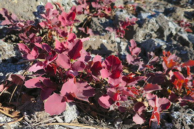 |
| Winter color. |
After slipping and sliding for an hour, a snowed-over place where an ATV road might be beckons. The USFS maps I’d previously downloaded to my iphone (on Gaia GPS) indicates trail leading a couple of miles north past two stock tanks/ ponds to intersect the CDT. A loop can be made!
 |
| Mushy deep patches of snow make for slow plodding. |
 |
| Red sandstone bluffs are several million years older than the lava flows. |
The road/trail fades out. I check the terrain features against the topo lines frequently and play the “if I were a trail/road where would I go” game. I wonder how long ago someone has ventured this way.
 |
| Deer and coyote prints surround the muddy “tanks” |
Extending the nature loop by following old roads allowed me to get a deeper appreciation for this area and to understand the landscape by seeing it from more directions. I could get in a full day’s hike (complete with mud, ice, and snow bonus workout) without having to waste daylight driving to another area.
Important note: Follow local regulations concerning off-trail travel. Some areas require you to stay on the trail to protect the environment or resources. Respect local guidelines and know where boundaries of private land are.
More information:
El Malpais National Mounment
El Calderon Guide


My latest saying has been drive less, hike more! The trails and views may not be ideal but I'm sure enjoying being out longer and getting in a good workout.
ReplyDeleteI'm with you on the shorter drives, especially this time of year with fewer hours of daylight! :)
DeleteIt's been awhile since I've popped in here! Looks like you are having a lot of fun adventures. :) Hard to believe that lava was flowing in that area in what sometimes seems distant but really isn't that long ago in geologic time!
ReplyDeleteNew Mexico has proven to be a great place to spend the winter! :)
Delete