Sunday, July 29, 2018

Highlights of Cheaha

A weekend backpacking trip with a friend I haven’t seen in years. The Pinhoti Trail and Cheaha State Park are Fireflo’s home turf. Our trip featured highlights of the state park, wilderness, and forest service land surrounding Alabama’s highest peak.

Rolling waves of green fading into blue.
We’d last hiked a section of the Pinhoti Trail during a crazy winter thunderstorm. Our final water crossing of that trip remains the most difficult one I’ve ever done. I considered going back to finish that section of the Pinhoti this trip. But we decided to opt for places with more waterfalls and views.

Exactly what's needed on a hot July day.
The scenery proved to be just as pretty as anything in the southeast, but with less people.

Rock gardens.
Cascades.
Wildflowers abound on the Chinnabee Silent Trail. Why “silent?” It was built by Boy Scouts of the Alabama Institute for the Deaf and Blind.

Lilies
The Pinhoti Trail is part of the Great Eastern Trail and connects the to the Appalachian Trail by way of the Benton Mackaye Trail. In contrast to the busy AT, the tread was narrow in places and we saw no one.


This bit of the Pinhoti was overgrown. But at least there were no brambles!
Fireflo had previously hiked all these trails before but not in summer season or outside of the drought. While cooling off in one stream, we came upon a swimming hole she’d never noticed before.

A warm-up swim.
Then, one of the best swimming holes of the year.
We set up camp near a shelter and watched the rainstorm roll through from our protected perch in the pines.
Building clouds.
In between storms. Notice the moat around the shelter.
Gleeful to have a comfy place to hang out for the evening, share stories, and watch fireflies, before retreating to cozy hammocks.
***
At 5 AM, I woke up suddenly to shouting, "BEAR! BEAR! BEAR!"

Before I was even half-awake, I lept from my hammock and started yelling and banging my poles and running towards Fireflo's hammock, fully prepared for a fight.

Whatever it was had run off though. Apparently, it had brushed into Fireflo's hammock. She heard it panting. In retrospect, it could have been a fox or coyote.

After the rain.
We looked for tracks around camp and thought there might be some small paw prints, but nothing definitive.

What was plentiful were butterflies. I was glad for a relaxed itinerary so there was plenty of time to watch them.

Southern cloudywing sipping nectar from a buttonbush.


We also spent time exploring Cheaha State Park.

No visit to Cheaha State Park is complete without a trip up the CCC tower to the highest point in Alabama. The lasting legacy of the CCC never fails to astonish.
The Doug Ghee Accessible Trail had great views and lovely lichen and mosses along a surprisingly long boardwalk.
We topped off the trip with ice cream from the camp store! Once again, I'm really impressed with the botanical diversity and incredible scenery of Cheaha. It was such a treat to share it with someone who knows the hidden jewels of this area!

More info

Fireflo's Pinhoti Trail Journal
Pinhoti Trail Alliance
Cheaha State Park

Sunday, July 15, 2018

Heart of Darkness on the BMT

Longing for open sky, the ridgewalking and balds shown on the topo map for this section of the Benton MacKaye Trail seemed tantalizing. When I found that the trailhead was less than 2 hours away, I decided to make sections 14-16 of the BMT along the TN/NC border my weekend backpacking trip without researching anything else.
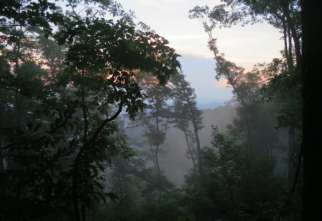
Misty morning

The ridgewalking seemed to stretch for miles but there were only tiny glimpses of sky through the tunnel of green. The reality of southeastern forests is that the nature here envelops you. A jungle-like greenery seemed to reach out to fill the air. Thick spider webs adhered to sweaty skin as if stuck with superglue. Nature was constantly flying into my eyes (no-see-ums!), buzzing in my ears, and biting through my skin (ticks, sweatbees, mosquitos!). Even the air itself seemed thick to breathe, laden with humidity.
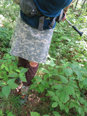
Wading through.

Along the ridge, beauty could be found not by looking out, but looking close at the tangle of life.
Rocks jutted up along the spine created ideal habitat for lichen and rockcap fern. Hill-topping butterflies danced along the ridge looking for mates.

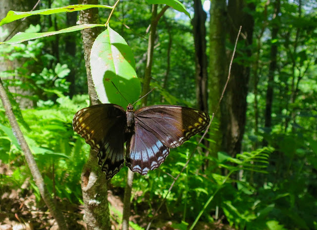
Red-spotted purple (Limenitis arthemis) mimics the coloration of the poisonous pipevine swallowtail to avoid getting eaten.
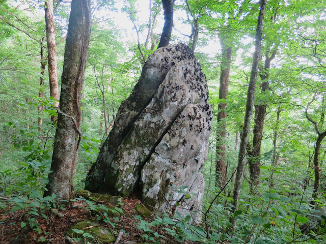
Rock with lichen and mosses.
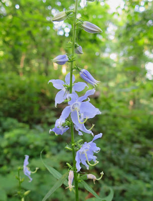
Tall bellflower

Little did I know that the BMT trail maintainers refer to this remote, jungle-like section as the “Heart of Darkness." Dedicated volunteers do regular brushing to open up the trail but the brambles grow back quickly each year. I hiked for miles through freshly brushed-out trail, thankful for their hard work.

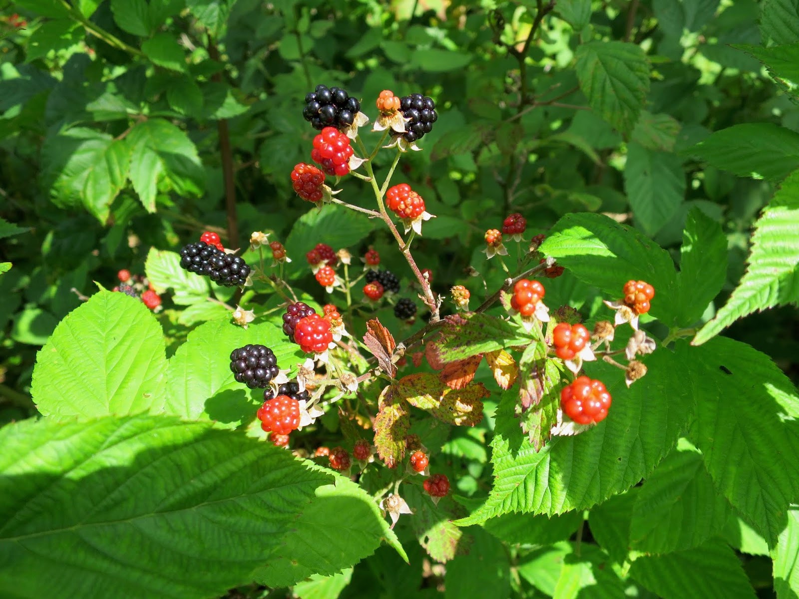
The culprit. Also, delicious.

But then I got to the end of the maintained section, where the brambles were thick and high. If only I'd checked the BMT website, I would have seen their warning. But alas, I didn't plan ahead.

How long do you hike through blackberries before you turn around? What if you are on an out-and-back? Knowing the further you go, that it only adds to the distance you will have on the way back.

Putting on my rainpants and diving into the neck-high mess.

I made it a mile. Had to because I was out of water in 90 degree heat and needed to get to the next spring. But after filling up at the spring, I cut my trip short and turned around. I'd had enough up-close nature.

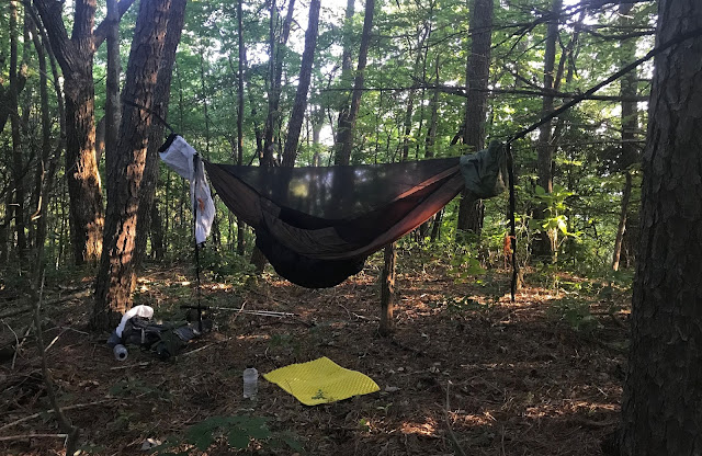
Always a good night's rest and thankful for a bugnet.
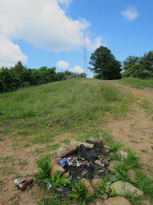
Side trip from Sixmile Gap up to Waucheesi Mountain. Finally got a view, even though the communication tower and trash detracted from the ambiance.

Details

This out-and-back backpacking trip was along the Benton Mackaye Trail from TN Hwy 68 to near Round Top (and back). It included parts of Sections 14, 15, and 16. This section is lightly used and no other people were seen.

The Benton Mackaye Trail Association has a great website with all the resources, maps, and information you need. Check it before you go so you can avoid problems.