Showing posts with label Wilderness. Show all posts

Monday, September 2, 2019

Day 27. Climbing South Sister

Day 27. Climbing South Sister
8/5/2019
Moraine Lake to the Summit of South Sister, then back to the PCT mile 1959 to mile 1962
3 miles on the PCT + 12 non-PCT miles
15 miles

My eyes open before my alarm goes off. Today is like a vacation from my vacation! What will the largest-glacier-in-Oregon look like? Will there be ice still on the high elevation lakes? What butterflies will be flying around at 10,000 feet? I think about all the PCT hikers down around the base of South Sister, while I am high up here in the alpine wonderland. It thrills me to be deviating from the PCT and making my own choices about where I roam.
Despite starting to hike by 5:20 AM, I don’t get on the actual climber’s route until 6AM. I have to hike all the way to Moraine Lake from my remote site, climb up from the lake and then cache my tarp/ sleeping bag/ hammock off the trail. With all the habituated chipmunks lurking, I decide to carry all my (4 days worth!) food. Heavy, but prudent.
I love the morning predawn hiking. Love the vastness and the exhilaration of the climb. The air smells delightful after the storm. The footing is really good after the rain- like the trail got compacted and cleansed. I can only imagine how dusty and loose it was the morning before. 
Three sets of footprints are in front of me. One set is small and I find out that they belong to a 4th grade girl hiking with her dad. Her sweet voice wafts on the wind and its delightful to meet her. 
When I get to the really steep uphill with loose rocks I come upon the lead hiker, and we end up hiking for most of the day together. R. keeps a steady pace and just tells me a few snippets of his story. I’m amazed that he is 70 years old! He is one of those people you can sense had lots of experiences over his lifetime, but doesn't brag. I feel lucky to have run into him. R. says that he wanted to hike this mountain today because next year they are switching to a permit system.

The first lake is amazing blue and the Lewis glacier above has deep blue ice.
A few young guys pass us on the way to the top, but by the time we get up there (just before 9), they are already heading down again so it doesn’t feel crowded. 
Instead, it feels like we are on top of the world and have it all to ourselves! Volcanos stretch out to the north and south, ones I’ve hiked around and have yet to hike near. The Three Sisters are all shaped so different even though they form from the same mountain building processes. R. talks about the geological processes that formed the features that he's hiked over the years.
On the way down, we run into A LOT of people coming up. It becomes very overwhelming and I hurry to turn off the Climber’s Trail back onto the side trail that will lead to the PCT. The experience of that massive crowd swarming up the mountains makes me see why they will have a permit system. I’m very grateful for my early start because I feel like the crowds didn’t negatively impact my experience of climbing the mountain. 

I take a circuitous route back to the PCT, instead of the direct route, so I skip less of the PCT. The view of South Sister from the PCT is still beautiful, but it makes me really glad I climbed it so I could experience it up close.
I make camp early (4 PM!) since I don’t need to get to hwy 20 until Thursday. And because I’m tired and have been up since 5 AM.  I delight the mosquitoes by fetching water and bringing it back to my campsite for a sponge bath. I’ve not felt so sweaty this whole trip. The rinse off feels delightful and the mosquitoes sure are pleased by the meal!

As I lay in my hammock and calculate my daily mileage, I discover I bypassed 6.7 miles of the PCT with my 22 mile Elk Lake/ South Sister alternate. Of course some people will still say that because I didn’t hike the official PCT route, that this makes my hike “invalid.” To this I can only laugh. I gained so much with my side trip— getting to see the glacier up close, experiencing an incredible view, and the butterflies up there were just amazing! I’m so glad to have the experience of that extra adventure. It was definitely one of the highlights of my whole summer.

Friday, August 10, 2018

Standing Indian, A Goodbye

Standing Indian in the Southern Nantahala Wilderness of North Carolina was the obvious choice for my last backpacking trip for a while in the southeast. (News flash: I’m moving back to Utah next week!)

A focused, clear path from here to there.
I've been yearning for views since moving back east. Not partial views through the trees, but 360 views of open sky.  And hoped to find a particular wildflower that grow in this botanically rich area.

Mostly though, Standing Indian holds many memories. I've been told I have a lousy memory for certain things. I call it being good at forgetting unnecessary stuff. But being in a place can help me to recall and reflect. Something that helps in a time of transition.

On the way up to North Carolina, I stop at a friend's cabin in the mountains for the night. A relaxing evening listening to the chorus of cicadas, talking about the joys and challenges of being a seasonal park ranger, and saying goodbye-for-nows.

I wake up to pancakes with blueberries from the garden! Life doesn't get much better!

Before I know it, I'm up at the Standing Indian Campground/ Backcountry Information trailhead. The Kimsey Creek Trail, the blue-blazed trail leading to the Appalachian Trail, never fails to delight. Sounds of the cascades filling the coves in stereo. A profusion of summer wildflowers-- the hot pinks of beebalm, joe-pye weed, and whispy delicate cranefly orchids, among other treasures. Maybe this is my favorite trail in the southeast. (Ya'all know I say that about whatever trail I'm on though...)

A sunbeam illuminates a rattlesnake plantain orchid.
When I pass a particular swimming hole, a memory of a trip with dear friends many (edit: 7!) years ago comes to me. I've only reconnected with a few of my friends from back then in these few months I've been here. Did I make enough of an effort or are diverging paths just a natural part of life?

The refreshingly cool waters of Kimsey Creek.

Up on the Appalachian Trail, wildfires that swept through in 2016 opened up the canopy completely changing the scenery from what I remember before I left in 2014. So much change! Blackened tree trunks and glimmering white rocks sparkling in the sunlight. (The rocks so white because the lichen got burned off, the sunlight so bright because the canopy is no more). The understory is now a riot of blooming wildflowers teeming with butterflies.

At first I am shocked by how much has changed, but then I meet some locals who say that fire is a natural part of this ecosystem. Native plants are thriving after the fire came through. It is good to be able to see all the change as a positive, necessary force for ecosystem health.

Seeing things with a new perspective.

The Appalachian Trail circles along the ridge for many miles, gentle and rolling and I glide along. Grades that were kind to me when I was first starting out backpacking. Now perfect for simply being present. Watching butterflies and delighting in the wildflowers. The joy that comes when you realize that you are exactly where you most need to be in the world.

If you stop chasing them and be still, they will just come to you.
Dancing along with joe-pie weed nodding to the beat.
A mother and daughter team are already set up under the Albert Mountain firetower when I arrive.  I feel bad about invading their space... and I really want to watch sunset from the tower.  So I go over to chat. They are new to backpacking, are surprised I'm solo, find out I've hiked in one day what they have covered in two, and start asking about gear and for advice.

I am flooded with memories of my early backpacking trips right here. All the things I didn't know and all the things I used to think were scary and thought were important that turned out not to be.

"You are doing it exactly right," I say, "in simply being out here. You picked a great place. The most important thing is to get out as much as you can!"

Finally, I get around to asking would they mind if I set up out of sight and returned for sunset?

Of course not!

By the time I tucked my hammock into a little spot and return, they are already in their tent for the night. I am relieved that I won't be invading their space as I tiptoe up the firetower and for the 360-degree evening show.

Watching the clouds do their swirling thing as the light changes and thunderclouds build.

Gazing in wonder.
As the colors deepen and get pinker, the lightning gets closer and I decided the fire tower may not be the best place to be.
 Owls hoot back and forth. A gentle wind blows but the storm passes somewhere else. My hammock provides me with deepest, most satisfying sleep.

Sunrise at the tower.
The next morning, a side trip to see the Wasilik Poplar. Which used to be the largest tree east of the Mississippi. Though now it is dead, the towering trunk is still breathtaking.

What remains
In the 1930's there used to be two huge poplars here but the other one got cut down by loggers. Legend has it that the only reason this one wasn’t cut down is because the team of oxen was too exhausted to come back for it after hauling the other one up the hill. The rich cove where it is found is still home to diverse wildflowers and makes a peaceful spot for contemplaing change.

water
I don't know when I'll be back. But I'm overwhelmed with gratitude for this place and to the people that taught me so much here.

More Information

Go see the Wasilik Poplar

Protect the Southern Nantahala Wilderness 

Sunday, July 15, 2018

Heart of Darkness on the BMT

Longing for open sky, the ridgewalking and balds shown on the topo map for this section of the Benton MacKaye Trail seemed tantalizing. When I found that the trailhead was less than 2 hours away, I decided to make sections 14-16 of the BMT along the TN/NC border my weekend backpacking trip without researching anything else.

Misty morning

The ridgewalking seemed to stretch for miles but there were only tiny glimpses of sky through the tunnel of green. The reality of southeastern forests is that the nature here envelops you. A jungle-like greenery seemed to reach out to fill the air. Thick spider webs adhered to sweaty skin as if stuck with superglue. Nature was constantly flying into my eyes (no-see-ums!), buzzing in my ears, and biting through my skin (ticks, sweatbees, mosquitos!). Even the air itself seemed thick to breathe, laden with humidity.

Wading through.

Along the ridge, beauty could be found not by looking out, but looking close at the tangle of life.
Rocks jutted up along the spine created ideal habitat for lichen and rockcap fern. Hill-topping butterflies danced along the ridge looking for mates.

Red-spotted purple (Limenitis arthemis) mimics the coloration of the poisonous pipevine swallowtail to avoid getting eaten.
Rock with lichen and mosses.
Tall bellflower

Little did I know that the BMT trail maintainers refer to this remote, jungle-like section as the “Heart of Darkness." Dedicated volunteers do regular brushing to open up the trail but the brambles grow back quickly each year. I hiked for miles through freshly brushed-out trail, thankful for their hard work.

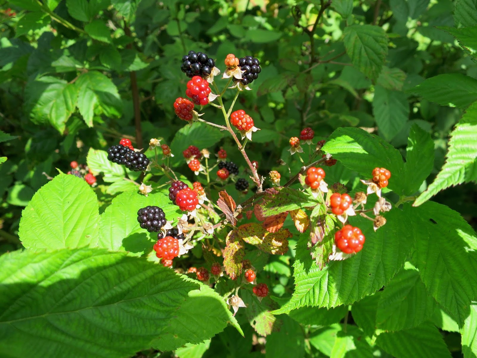
The culprit. Also, delicious.

But then I got to the end of the maintained section, where the brambles were thick and high. If only I'd checked the BMT website, I would have seen their warning. But alas, I didn't plan ahead.

How long do you hike through blackberries before you turn around? What if you are on an out-and-back? Knowing the further you go, that it only adds to the distance you will have on the way back.

Putting on my rainpants and diving into the neck-high mess.

I made it a mile. Had to because I was out of water in 90 degree heat and needed to get to the next spring. But after filling up at the spring, I cut my trip short and turned around. I'd had enough up-close nature.

Always a good night's rest and thankful for a bugnet.
Side trip from Sixmile Gap up to Waucheesi Mountain. Finally got a view, even though the communication tower and trash detracted from the ambiance.

Details

This out-and-back backpacking trip was along the Benton Mackaye Trail from TN Hwy 68 to near Round Top (and back). It included parts of Sections 14, 15, and 16. This section is lightly used and no other people were seen.

The Benton Mackaye Trail Association has a great website with all the resources, maps, and information you need. Check it before you go so you can avoid problems.

Wednesday, June 27, 2018

Big Frog on the BMT

A short overnight backpacking trip on the Benton Mackaye Trail Section 11 in Tennessee provided two favorite summertime treats: swimming holes and ripe berries. Perfect for the intense heat!

Section 11 of the BMT climbs gradually from a low point at the Ocoee River (1120 feet) up and over the summit of Big Frog Mountain (4224 feet), namesake mountain of the Big Frog Wilderness, and then down to Double Springs Gap at the Georgia/ Tennessee border.

Ocoee River
The start of the hike crossed over several dirt roads but then finally entered the wilderness. Following old logging roads made for easy hiking.

Former logging roads turning back to nature.
 Ripe red raspberries grew in thickets along the old roads. Sweet and juicy. The taste of summer.

All mine.
It felt great to enter into the wilderness area. The Big Frog Wilderness of Tennessee borders the Cohutta Wilderness of Georgia. Combined, they form the largest tract of Wilderness USFS land in the eastern US. This section only had "winter views" which meant that there were only partial views obscured by leaves. But at least I could imagine the vastness.

Once in the wilderness, the BMT follows the West Fork of Rough Creek, one of the prettiest places I've been to in the southeast. Hemlock and great rhododendron in full bloom line the banks of this sweet bubbling stream.

Massive pink blossoms filling the air.
Plunging into a bubbling creek on a hot summer day might just be one of the greatest pleasures in life. I splashed around for what seemed like hours, with butterflies and jewelwings dancing around my head. A lazy lunch on mossy rocks while soaking my feet, until my feet turned to prunes. Even though I've had some pretty epic swims in the last few years, this one stands out for the lovely wildflowers, insects, and jacuzzi-like water, and because it was so intensely hot out.

Definitely one of the best swims EVER!
Azures all around.

Long tunnels of mountain laurel
Even though there were only obscured views through the trees, the ridgewalking went on for miles. And there was a wonderful sense of being up high.

 Big Frog Mountain (4,224 feet elevation) is named by the Cherokee for the spring frog, which emerges early in the season. I didn’t get to see any frogs, but salamanders were out roaming before the storm.

A woodland salamander prowling around
Other wildlife was abundant. I startled two black bears who ran off.
This timber rattlesnake stayed put on the trail. So I was the one who went the long way around.
On the approach up Big Frog Mountain
Once I got to the top, I continued south down over the crest. A steep mile or so that descended a bit over a thousand feet. The turn around point of my trip was Double Springs Gap, which indeed has two springs, one on either side of the Tennessee Divide. One side goes out the Conasauga River to the Tensaw River to the Gulf of Mexico at Mobile Bay. The other spring flows to the Ocoee River and eventually to the Mississippi. After cooling off at both springs, I turned around and climbed back up Big Frog, and descended more gradually going northbound.

Evening.
Storms came rolling through in the evening, but not before I had set up for the night. I'd forgotten just how much I love the sound of rain on my tarp. The skies cleared the next morning for the quick hike back to the river.

A sub-24 hour trip, but it was good to get out!

Red-spotted purple butterflies are a great example of a Batesian mimic. They show similar coloration to the unpalatable pipevine swallowtail, so predators are fooled into not eating them even though they are palatable.

More information 

I did this as an out and back from Thunder Rock Campground, which has good parking for BMT hikers.

Here is the trail guide from the BMT association

A Quick and Dirty Guide to the BMT

Thursday, May 31, 2018

Returning to Standing Indian

I knew exactly where I wanted to go for my first trip in the southeast. Standing Indian Mountain in the Southern Nantahala Wilderness of North Carolina offers outstanding views and the botanical diversity can’t be beat. At least that's how I'd remembered it when I'd left here in 2014.

In particular, a favorite place of mine is a particular tunnel of purple rhododendron on the eastern slope of the mountain. In my memory, I can envision the gently curving twisting trunks supporting a riot of deep purple blossoms. To walk through is to be enveloped by beauty.

Heavy rains fell during the long drive to the trailhead. It has rained every single day since I’ve been back East, so this was nothing new.
A roaring Kinsey Creek overflowing its banks.
The rain persisted as I started up the Kimsey Creek Trail. The whole trail had been transformed into a stream.
Drenched.
I sloshed through the water, often up to my ankles but sometimes higher. Waves of rain pounded down, alternating with heavier, drenching rain as I joined the Appalachian Trail at the ridge.

Some parts were deeper.
I’d been up this trail many times, but this is not how I remembered it. What shocked me at the summit of Standing Indian was not that there was no view, but that the heath shrubs were scorched by fire. What had happened since I’d been here last in 2014?
No view, no flowers.

A check of the weather indicated more thunderstorms on the way. An alert revealed that subtropical storm Alberto was passing through. That explained everything!

I hurried off the summit, still anticipating the purple rhododendron grove.

Instead I found blackened trunks of the rhododendrons and the bare branches. Fire had killed this grove. How could I not have known this? I was totally shaken and flooded by waves of homesickness, not for any place in particular, but rather for a sense of belonging. It felt like I was utterly alone. What was I doing out here anyway, shivering in the horrible rain, far away from everyone I have ever loved?
Turns out a fire raged through here in 2016.
Just as I was sinking deeper into a self-pity party, four soaking wet hikers came up the trail. They’d been unable to cross a raging river ford up ahead. Other hikers were camped down at the gap, waiting for the water levels to fall.  Did I have any cell service to call a shuttle to pick them up to give them a ride into town?

Part of me wanted to go see if I could find a way across, but then I caught the eyes of a father and looked at his limping daughter. Automatically, I offered all four of them rides to whereever they needed to go.

I’d remembered the hike down the Lower Ridge Trail as taking only two hours. But it took us nearly four, with much slipping and sliding.
The young daughter spotted two salamendars! How cool!
As we hiked, we traded stories and helped each other over downed trees. It reminded me about everything I love about the Appalachian Trail— how quickly friendships are made, how people from different walks of life can come together. Hiking as a group and helping each other out was uplifting and gave me that sense of belonging that I needed to find.
Amazingly, we squeezed all five of us plus backpacks into my tiny car! Not the trip I'd expected, but exactly what I needed.
Making it all fit!