Sunday, September 15, 2013

Overnight Loop on the Foothills, Winding Stair, and Big Bend Trails

Wanting to explore two trails that link to the Foothills Trail in South Carolina, I devised a 16.4 mile loop for a solo overnight on the Foothills Trail, Winding Stair Trail, and Big Bend Trails.  After section hiking the 77-mile Foothills Trail, I've been hiking all the spurs and side trails that connect to the Foothills because I love the area so much.  This loop turned out to be a very scenic, easy route with four impressive waterfalls and several unnamed smaller falls.  Even the roadwalk had a small waterfall!
Unnamed cascades along the Winding Stair Trail.
I parked at the Foothills Trail access at Cheohee Road (FS 710) right off SC 107.  If I were to do it again, parking at Nicholson Ford would have been safer, but this gave me a shorter drive.  The loop began with a 2.5 mile roadwalk down FS 710.  It was pleasant walking with views through the trees and diverse fall flowers. 

Winding Stair Trail (3.5 miles) headed up into the forest on the left after crossing Crane Creek over a bridge.  The parking area was unmarked but the trail itself was signed and adequately blazed.  This hidden gem is mostly used by dayhikers (i.e. no campsites evident).  Broad switchbacks wound gently up the hillside so the 1000 foot elevation gain was effortless.   Paths to two waterfalls required steep scrambles down rhododendron thickets, with much ducking required for tall people.  Miuka Falls was an impressive 70-foot cascade and Secret Falls was smaller but picturesque.  

After crossing SC 107, Big Bend Trail led 2.7 miles to the Chattooga River Trail/Foothills Trail.  It passed through really pretty forest, typical for the Chattooga River area, with large trees, doghobble lined streams, and mountain laurel.  Pine-needle cushioned trail made for easy walking. 
Pinesap lacks chlorophyll and gets its carbon by parasitizing fungi associated with pine trees.
Giant pines on the Big Bend Trail
Off the Foothills Trail, steep social trails through rhododendron tangles crisscrossed the riverbank overlooking Big Bend Falls.  You could feel the ground rumbling as the powerful Chattooga River thundered through narrow canyon.  I never did get a good photo, but believe me it's worth seeing (and hearing!).
Camping along the Chattooga River.
I set up camp on a sandy beach north of Rock Gorge along the Chattooga River.  After being focused on hiking and the trail, I finally had some time to think.  It was a tough week at work- I received the unexpected news that the funding for my job is ending sooner than I'd been previously told, and I'd been feeling very unsettled the past few days.  Thankfully, watching the sun set and the moon rise above the hills over the river was quite restorative.

The Chattooga River is one of those really special places for me.  I feel so at home in the forests through which it flows.  Its large evergreen trees, rhododendrons and ferns remind me of the forest of my childhood in Oregon.  I have made so many memories of trips on the trails that intersect the Chattooga- the Foothills, Bartram, and Chattooga River Trail.  It's tough thinking about leaving this place and all the friends I've made here, but it's also exciting to dream about what I'll do next. 

I woke early to hike the few miles to my car on the Foothills Trail, passing yet another falls.  It was a short trip, but exactly what I needed.
Lick Log Falls on the Foothills Trail.
For more information:

Tim Homan's Hiking Trial of the Southern Nantahala Wilderness and Chattooga River.

Trails Illustrated #778 Brasstown Bald and Chattooga River

Tuesday, September 10, 2013

On the JMT... of Tennessee

I couldn't help boasting about this trip, "This weekend, I'm backpacking the JMT… of Tennessee!"
The John Muir National Recreation Trail goes 20 miles along the Hiawassee River gorge in eastern Tennessee.  John Muir traveled this route on his long walk from Kentucky to the Gulf of Mexico, and Muir's description  (see here- read under Sept 19) of the incredible river still aptly describes the wonder of this river today.  
Water levels were low enough to exposed the unique jagged rock formations of the Hiawassee River.
My friend Salt and I began at the western end at Childers Creek trailhead, and we highly recommend the scenic first 3 miles to Big Bend.  It's well maintained and follows the northern bank of the Hiawassee River below towering bluffs.  The Benton Mackaye Trail Section 13 is concurrent with this part of the JMT.  
Fascinating geology and diverse plant community including pawpaws, one of my favorites.
Past Big Bend Parking Area, Hiawassee River Road is popular with fishermen, and there are frequent parking areas and boat launches with trashcans, picnic tables, and bathrooms.  The area (especially the nearby Ocoee River) is also a mecca for whitewater rafting and kayaking, and we wondered a few times why were hiking rather than staying cool in the water like the fishermen and boaters.
Joe pye weed along the Hiawassee River.
Lunch at one of the many picnic areas along Hiawassee River Road.
From Big Bend to Towee Creek, the trail left the river and ascended a very short distance up the hillside.  We stayed within sight of the road so it was pretty much like walking along road, only rougher and more difficult.  I'm not sure point of this but it did take us to an overlook along some rock formations.

The 2008 reroute between Towee Creek and Wildcat Creek led further away from the river and up over a tall bluff.  We followed beautiful Towee Creek before switchbacking up to the spine of the ridge.  It was a hot humid climb and we were dripping in sweat.  Afterwards we joked that we'd bagged a 14er.  Such bad-ass JMT hikers!  Of course it was only a 14-hundered footer, but whatever...
It was hard going.  Gnats were especially vicious and kept flying into nose, eyes, and ears. 
Our original plan had been to camp at Coker Creek, but the heat and mugginess had sapped so much energy that we decided not to go any further.  Hammocks were hung above a bluff over Wildcat Creek.  We had dinner under a rocky overhang, and soaked tired feet in the river while swatting (unsuccessfully) at the blood-thirsty no-see-ums.

In the morning, we decided to follow the old route of the JMT/BMT on the return trip to the car.  The section was much more used and still marked with signs and blazes all the way to the suspension bridge over the Hiwassee River and the Apalachian Power House.
Walking along the old route (rather than the reroute) provided lovely views of the river.  There were fishermen out all along this peaceful stretch of water.
The old trail markers showed where the old route used to veer off the road into dense forest along the riverbanks.  We followed the blazes through really overgrown trail and eventually got tired of fighting the thick brush.  We suspect other hikers also must walk the road which was much more pleasant.  Though I wonder how many people hike this stretch- we certainly didn't see any other backpackers, just one dayhiker, and lots of fishermen.
Overgrown section.
Just before we got back to the trailhead, as I was strolling along looking up at the pawpaw, Salt shouted something from behind me.
Looking up at the tons of pawpaws all along the trail.
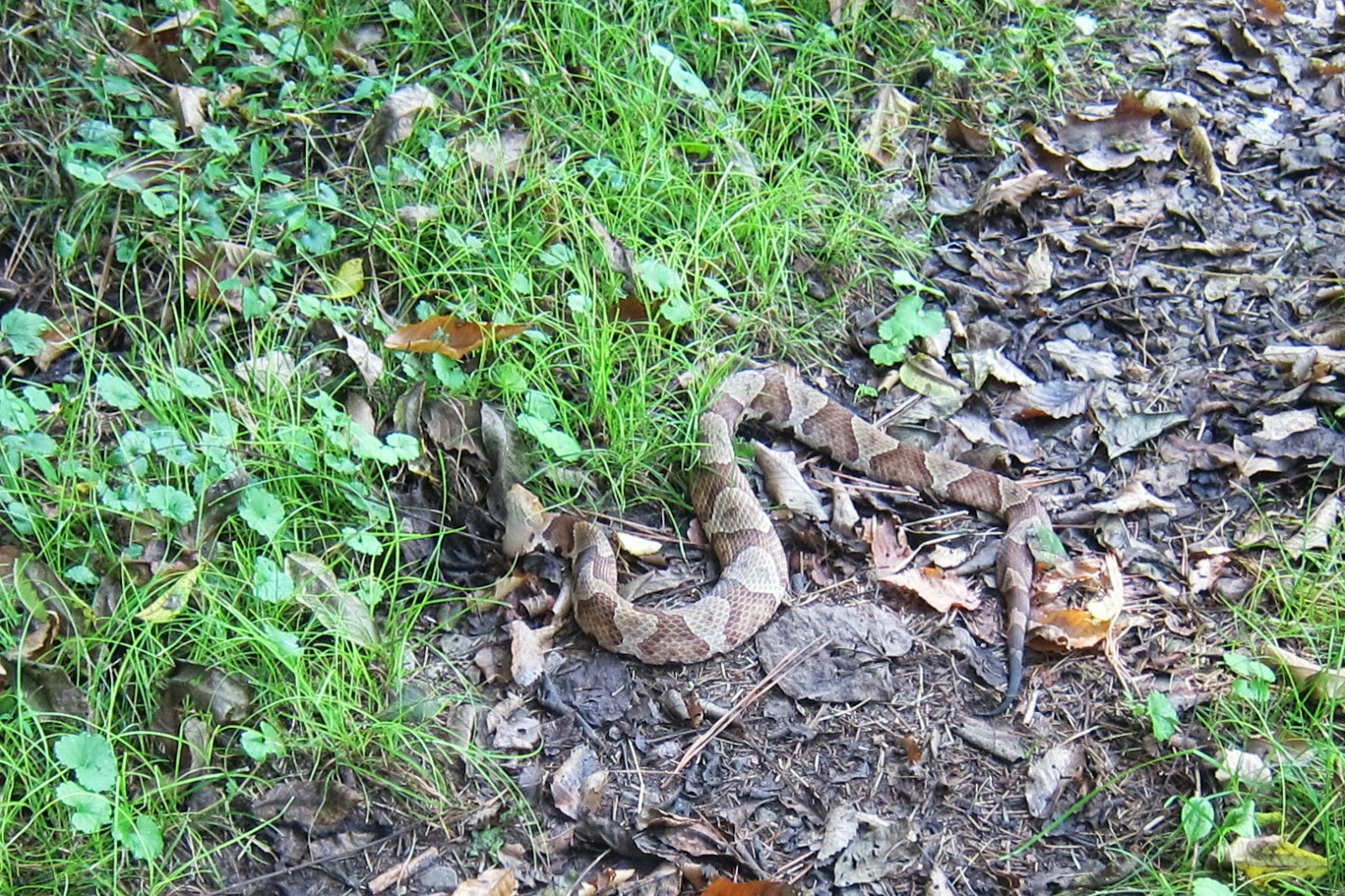
I walked a few steps further before turning around.  She exclaimed that I'd stepped on a snake!   Sure enough there was a copperhead in the path looking very angry. 
Anyway, she saw the snake move when I stepped on it, but it didn't bother me, not even a nibble.  And he looked to be still very alive.  Ironically, she'd just been talking about seeing a snake and how snakes are reported to be common along this section of trail.  I've since read that copperhead bites are really rare, that they only inject venom half the time anyway, and thought it's painful, hardly ever deadly.  Not that I'd ever step on one on purpose, but it's another thing that I'm not gonna fear.

Overall, the first few miles of the JMT from Childers Creek were exceptionally pretty and I think they'd make a fantastic day hike, especially in fall or winter when the weather wouldn't be so brutally hot.  It was great to be on the trail with my friend Salt and on the way home we scouted out the next trailhead for the BMT so I'll look forward to returning to this area for more adventures.

Information and trip planning notes
(note: information on the John Muir National Recreation Trail was really disappointing and lacking so I've included an annotated description of resources.)

Sherpa Guides has some regional information here.

The BMT Trail Guide for Tennesse showed the old and new reroute, which was helpful.  However, it wasn't as detailed about the confusing road crossings.

The Trails Illustrated map #781 Tellico and Ocoee Rivers is easier to read than the trail guide, and shows road access.  However, it didn't show the old BMT route, even though both new and old routes are still signed and blazed.  Potentially very confusing.

This Backpacker Magazine article on the JMT at least had directions to the trailheads and for the shuttle.  However, it doesn't describe the reroute even though it was published in 2010, and the description made us wonder if the author had actually hiked the trail.

Unfortunately, the BMTA trail descriptions that had been so helpful for sections 1-11 are not available for this section, but a map is available for free download.

Friday, September 6, 2013

Side Trails off the Foothils Trail, Part 2

Labor Day weekend on the Foothills side trails continues... (see here for Part 1)

After a restful night on Sassafras Mountain (highest point in South Carolina), my friend Still Waters and I drove over to the  Frozen Creek Access Area to begin the second part of the trip- an 18 mile loop through Gorges State Park in North Carolina on the Auger Hole, Foothills, and Canebreak Trails. 

I was both suspicious and thrilled that the trailhead was deserted when we arrived.  There had to be a good reason for that on a holiday weekend and I figured we'd soon find out.
Auger Hole Trail.
The 7.3 mile Auger Hole Trail wasn't the prettiest trail.  Wide doubletrack, thick spiderwebs, biting gnats.  It took effort to find beauty.  Brilliant green tiger beetles scampered up the trail.  Sometimes, you just have to settle for the little things.
Brief break from the heat at the crossing of the Toxaway River on the Auger Hole Trail.
When the trail opened up into a hot powerline cut, there was especially slippery loose gravel and rock.  Ugh.
I'm usually sure-footed, but I fell going down this steep part.
I was overjoyed to finally reach the soft surface of the Foothils Trail and step back into verdant forest.  While the Oconee Bells weren't blooming like when I'd backpacked this section last March, their lush evergreen leaves glistened along the banks of small babbling streams.  At first glance, they might look like galax, but you can tell they are actually the rare Oconee Bells by the leaf venation patterns. All thoughts of the previous section of tough trail were overshadowed by the botanical splendor.  A selective memory does wonders for ones general happiness.
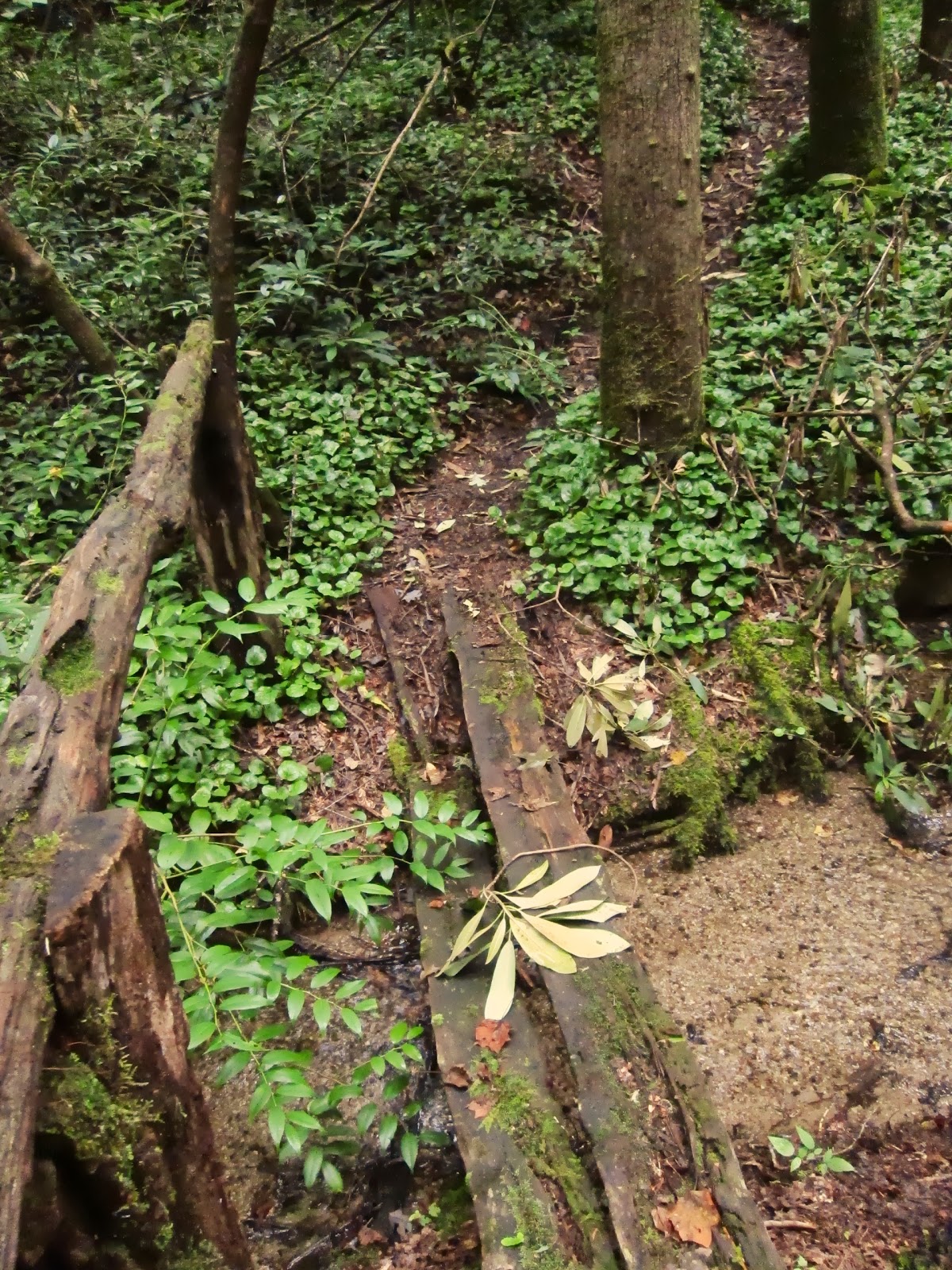
Bridge over small stream on the Foothills Trail.
After 13 miles of solitude, I was pissed off when I heard motorboats and loud voices as I descended to the banks of Lake Jocassee.  I lightened up a bit when I saw kids frolicking in the shoals where the Toxaway River empties into the lake.  I was even more pleased when they all took off in their boats in the evening as the thunderstorms rolled through, leaving us in peace.
Morning light at the Toxaway River flowing into Lake Jocassee.
Next morning, it was five miles up the Canebreak Trail.  I honestly can't think of an uglier trail.  
The initial steep ascent up the Canebreak Trail, which follows more old roads.
Loose gravel make for tough walking on tired feet.
In an ideal world, there'd be more places that offered both solitude and scenic splendor.  But as it is, there is a tradeoff- in this case (ugly) trails provided solitude.  We encountered no other backpackers all weekend, though there were a few folks out for the day within a mile of the trailheads.  For a holiday weekend, it was worthwhile to put up with the trails over old roads to have some quiet and stay off the beaten track.  Plus, these trails led to places that were spectacular, despite being crowded with daytrippers that accessed them with their cars (on Sassafras Mtn) and motorboats (at Lake Jocassee).  It worked out well to have some of the best of both worlds.
The only other footprints on these trails were made my turkeys.
For more information on this loop:

Backpacker Magazine article.

Meanderthals Trip Report here.

Tuesday, September 3, 2013

Side Trails off the Foothills Trail, Part 1

Ever since I finished my hike of the Foothills Trail last year, I've been wanting to do the Foothills Spur as well as two side trails that form a loop with the Foothill Trail through Gorges State Park.  So I did a rather unusual configuration this Labor Day weekend to backpack all these trails.  My friend Still Waters give me a shuttle the first day, and then we drove to a different trailhead for the second night.  The extra driving was worthwhile because these side trails provided opportunities for exploring and adventure, and also had exceptional solitude.

Foothills Spur: Caesars Head to Sassafras Mountain (14.2 miles)

The first day my friend Still Waters drove me to Caesars Head State Park.  The Foothills Spur shares tread here with the Raven Cliff Falls Trail and the Gum Gap Trail, which had been closed when we'd visited the park a few weeks ago.
Starting out in fog on gentle trail.
After the first few miles, the Foothills spur follows a series of old roads, some of which I was delighted to learn were built in the 1930's by the CCC.  Often rocky, these roads made for difficult hiking and much time was spent looking around for rather sparse or worn blazes and consulting the map.
Warning sign say to stay on blazed trails to avoid getting lost.
The trail passes through the Watson-Cooper Heritage Preserve, which has the only montane bog in South Carolina, and harbors several rare plants.  An old book gave rough directions to the bog which involved unmarked/ unmaintained trails that I wanted to check out so I can go back next spring when the swamp pink are in bloom. I got totally wet and covered in mud from stooping under rhododendron thickets and tromping around in the bushes.  What fun, though I wished I'd only been carrying a daypack instead of my backpacking pack.  I was also really happy too not to get lost after passing those warning signs.  
Not very rare, but still pretty yellow fringed orchid at Watson-Cooper Heritage Preserve
Venturing down an unmarked side trail provided the most spectacular view of the day.  From the summit of Bursted Rock Mountain (3219 feet), an expansive rocky outcrop opened up to the south for a view of what I think must be Table Rock.  I stumbled upon this by veering south off the Foothills Spur (less than a mile east of Dolves Mountain) and following the orange blazes marking the NC/SC border for about a quart of a mile strait up the mountain.  Not sure how many people know about this place because it was really overgrown.
Rocky expanse on Bursted Rock Mountain.
View from Bursted Rock (though the geological marker said "Bursting Rock").
The view from Dolves Mountain was much easier to find- it was right on the trail- but not quite as impressive. 
Looking north from Dolves Mountain.
When the trail finally turned into the woods onto singletract path, the terrain got very steep, though I was relieved for the soft trail.  This switchback-free trail following spine of mountain along NC/SC border all the way up to Sassafras Mountain (3553 feet), the highest point in South Carolina.
Big steps up.
I met Still Waters up at the summit, and we watched bats swoop across the sky as the sun set. 
Watching the sunset from Sassafras Mountain.

Stay tuned for Part 2...

For more info on the Foothills Spur Trail:

     Meanderthals Trip Report here.

     Foothills Trail Map.

     Johnny Molloy's Long Trails of the Southeast.

Thursday, August 22, 2013

Gear lists

Making gear lists has been enormously helpful for prioritizing my gear purchases and DIY projects, and has helped me keep track of what I use and don't need anymore.  I used to make them for every trip, but lately, I haven't bothered much with them, except for when I have a specific problem I'm working through.  For example, I'm currently researching new top quilt designs, so just updated my gearlists to help decide what specs to make the new quilt.
My gear at the time I took JJ's lightweight backpacking class in 2011.
I've never posted a gearlist on my blog.  But I love reading other people's and find them quite telling.  I see them as ways to learn about someone, and to get a feel of the perspective that they offer.  They are also helpful for getting new ideas.  So it is in this spirit that I share my summer, fall/spring, and winter gear lists for weekend backpacking in the southeast.  I've also started a new page to provide an easy reference to my blog posts on gear.

Want to make your own gear list?

     Backpacking Light has a variety of templates.

     Stick recently posted a form you can download.

Friday, August 16, 2013

Why I love hammocks

I've mentioned a few times that my hammock is one of my most prized gear items, so I wanted to take explain why I love my hammock so much.  I've been a hammock hanger since 2010, and I find two primary advantages:

-A good night sleep = ability to hike further and overall increased happiness.   It was a huge breakthrough for me to finally figure out a way to get quality sleep while backpacking.  When I was a ground-dweller, I tossed and turned all night and never managed a deep sleep, and my hips ached the next morning.  In my hammock, I fall asleep quickly and sleep deeply through the night, waking up refreshed.  My legs and feet recuperate and I don't feel sore the next day so I can hike more comfortably.  I credit this all to the comfort and the unique body position provided by the hammock.
My Warbonnet Blackbird hammock with Yeti 3-season underquilt
-Greater flexibility in where I can camp.  In the southeast where trees are plentiful, I find I have more options since I'm not restricted to flat ground free of vegetation. 

When I was taking my first solo backpacking trips, I cannot stress enough how pivotal it was to feel like I could camp anywhere.  I moved to Georgia a few months after Meredith Emerson was murdered on Blood Mountain, and most everyone told me not to hike alone.  I spent a lot of time my first solo trips lying sleepless and scared in my tent jumping at the faintest russel in the night.  It was a huge deal for me when could stealth camp in my hammock because it allowed me to finally feel safe in the woods. 

Now I'm a much more confident backpacker, and I've come to prioritize hiking longer miles.  I still appreciate the ability to camp anywhere because it means I can hike until later in the day because I can more easily find a site when I'm ready to stop for the night.   There have only been a few times that I've had trouble finding a site while hiking in very steep terrain.
Even my worst hang between too closely spaced trees covered in poison ivy wasn't all that bad.
Other things I appreciate about hammocks:

-A deeper sense of connection to my surroundings.  With an elevated perspective and lack of attached rainfly, I have the ability to see out and it feels more open.  I have flexibility in how I pitch the tarp (i.e. I can convert into porch mode), or whether I pitch it at all.  Sure this is also possible with some tents or tarps, but it's very easy with a hammock.

-Modularity of the system.  Hammocks and tarps can be mixed and matched, allowing greater flexibility and adjust to different seasons or situation.  Suspension systems can also be changed to be  more lightweight or to have more flexibility in size or spacing of trees.  They can also be set up low in the cold or wind, or higher in the heat to cool off.

-Stay drier and cleaner.  I also have plenty of living space in the rain- can fit several people under the tarp which makes for more enjoyable group trips.  Plus I'm no longer living in the dirt and mud.

-Easier to practice LNT.  Hammocks also have less impact on the environment since they don't compact the soil or plants.   And I don't have to move stick or rocks.

-Ease of setup and takedown.  It's super fast, so I can get out on the trail even faster in the morning.  More time to watch the sunrise.

-Hammock people.  I've really enjoyed meeting and learning from fellow hammock hangers.  Especially my friends who got me into hammock camping, and the folks I've met on Hammock Forums hangs.  Meeting all the other DIYers inspired me to make more of my own gear, including my DIY Karo top quilt.  There are also quite a few excellent cottage industries that sell hammock gear and DIY supplies.  All in all it's a great community!

Disadvantages of the hammock:

-Some people don't find them comfortable.  (Thankfully, I am not one of those people.)

-There was a bit of a learning curve for me and initially I was overwhelmed with all the jargon.  At first I thought all that stuff about angles, fancy ropes and knots mattered more than it really did.  I suspect it's just that folks get really into their gear, especially when it comes to hammocks.  I still need to practice when I get new gear or want to try different rigging though this isn't really a disadvantage.
Testing out my new Dream Hammock Darien UL in the backyard.
Overall, switching to a hammock had a profound impact on me as a backpacker, and really facilitated my comfort in the backcountry and gave me the confidence to explore more places.  I've definitely benefited from my "elevated perspective" and I encourage others to give hammocks a try.

Hammock resources:

Hammock Forums
Just Jeff's Hammock Camping Page
The Ultimate Hang
Shug's Hammock How-to videos

Tuesday, August 13, 2013

Mountain Bridge Wilderness

I've always heard how quickly water levels rise during flash floods, but it's something else to experience it directly.  To slosh through ankle high water on trails that were only just dry.  To hear the surreal roar of a ranging river crashing rock against rock.  This makes you understand how water can carve something like the Grand Canyon.

But this was in the rain-soaked southeast, in the Mountain Bridges Wilderness Area in South Carolina.  The Middle Saluda Scenic River cuts a gorge as it flows away from Caesar's Head State Park and through Jones Gap State Park.  I'd heard about the spectacular waterfalls and miles and miles of inner-connected trails, so even though it was a long drive, I finally decided to get a (required) reservation for a backcountry campsite.  A few days before, flooding and mudslides closed most of the trails.  However, the park rangers said my campsite was still accessible, so, with more thunderstorms in the forecast, I headed out for an overnight with my friend Still Waters.
Blue skies before the storm.  From the top of Caesar's Head, a granitic gneiss outcrop
As afternoon thunderstorms dumped rain on already saturated ground, I decided to backtrack to check out a falls I'd past earlier, Dargon's Cascade, rather than risk continuing on when we got to a ford that looked too dangerous.  Even so, the stream water crossings I'd rock-hopped were now up to my calves.  At the falls, the change in water level was astonishing to see.  The difference in the sound level was even more humbling. 
Dargon's Cascade before
Dargon's Cascade after
I was glad our campsite was perched on a low ridge well above the river.  Just minutes after pitching tarps and getting set up, another wave of evening thunderstorms came on suddenly and strong, and lasted well into the night.  Happiness was watching the storm from the shelter of the tarp while airing out waterlogged feet.  Backpacker entertainment- just sitting and watching the rain falling and lightening flashing, and rolling thunder, feeling appreciative for our little patches of shelter.
Campsite #14 on the Jones Gap Trail
More waterfalls.
The next day, water levels were down again.
200-foot Raven's Cliff Falls.